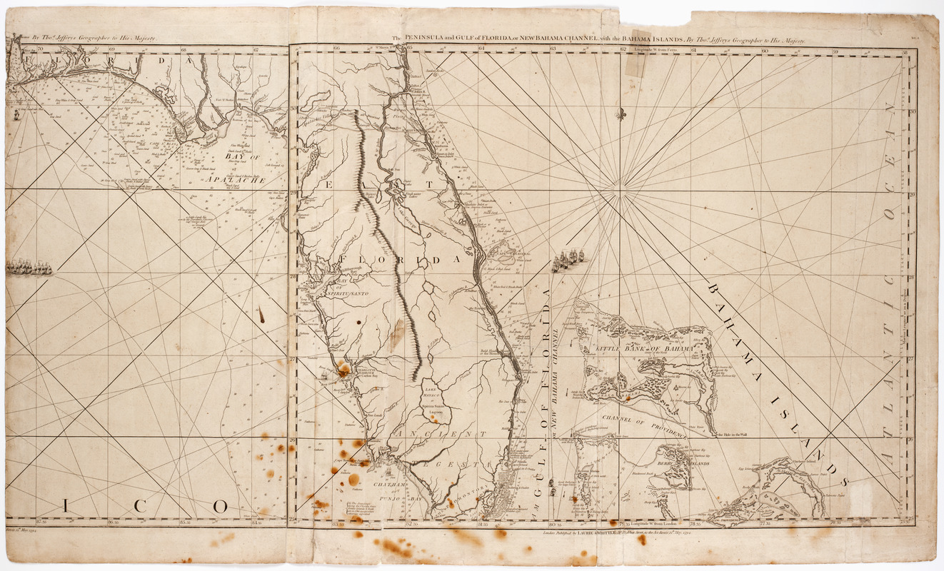
The peninsula and Gulf of Florida, or New Bahama Channel, : with the Bahama Island
This map is also available in American Revolutionary Geographies Online (ARGO), a collections portal especially built for material relating to the American Revolutionary War Era. Visit ARGO to learn more about this item and explore the historical geography of North America in the late eighteenth century.
Item Information
- Title:
- The peninsula and Gulf of Florida, or New Bahama Channel, : with the Bahama Island
- Description:
-
Subject: Map of the peninsula of Florida with the Bahama Islands seen just to the east. Shows a mountain range "The Great Sandy Ridge" running through the center of the state.
- Creator:
- Jefferys, Thomas, -1771
- Name on Item:
-
by Thos. Jefferys geographer to His Majesty.
- Date:
-
1794
- Format:
-
Maps/Atlases
- Location:
- American Antiquarian Society
- Collection (local):
-
American Antiquarian Society Collection
- Subjects:
-
Florida--Maps
Bahamas--Maps
- Places:
-
Bahamas
Florida
- Extent:
- 1 map on 2 sheets : engraving ; 48 x 62 cm., on sheets 55 x 34 cm. or smaller
- Terms of Use:
-
Public Domain/No known restrictions on use. Contact host institution to download image.
Contact host institution for more information.
- Publisher:
-
London :
Published by Laurie & Whittle, no. 53 Fleet Street, as the Act directs
- Scale:
-
Scale not given
- Language:
-
English
- Catalog Record:
-
http://catalog.mwa.org/vwebv/holdingsInfo?bibId=486358
- Notes:
-
Prime meridian: London and Ferro.
Relief shown pictorially. Depths shown by soundings.
In upper right corner: DG4.
The American Antiquarian Society has a manuscript tracing of an earlier edition of this map. See BIB 490277.


