Toggle navigation
LMEC Home
Exhibitions
Georeferencing
Tools for Teachers
Collections
My Favorites
Sign Up / Log In
Search
Search the map portal
Map Collection
Map Collection
Map Sets
Search
Search
Search for
Search In
All Fields
Creator
Title
Subject
Place
Search All Digital Collections
Advanced Search
2261 Results
My Search
Start Over
london
Remove constraint london
Filter your Search
Place
North and Central America
1,479
United States
921
Europe
363
Canada
347
North America
194
New York
128
Massachusetts
111
New England
104
more
Place
»
Topic
North America--Maps--Early works to 1800
137
Coasts--Nova Scotia--Maps
64
New England--Maps--Early works to 1800
57
United States--History--French and Indian War, 1754-1763--Maps
57
United States--History--French and Indian War, 1754-1763--Maps, Manuscript--Early works to 1800
56
United States--Maps--Early works to 1800
54
United States--History--Revolution, 1775-1783--Maps
40
Nova Scotia--Maps--Early works to 1800
39
more
Topic
»
Date
Date range begin
–
Date range end
Current results range from
1624
to
1999
View distribution
Creator
Des Barres, Joseph F. W. (Joseph Frederick Wallet), 1722-1824
242
Jefferys, Thomas, -1771
167
George, III, King of Great Britain, 1738-1820
149
George, IV, King of Great Britain, 1762-1830
148
Sayer, Robert, 1725-1794
115
Faden, William, 1749-1836
109
Moll, Herman, d. 1732
72
Robert Sayer and John Bennett (Firm)
57
more
Creator
»
Format
Maps/Atlases
2,219
Manuscripts
161
Prints
23
Drawings/Illustrations
15
Books
4
Objects/Artifacts
1
Georeferenced
Yes
137
No
2,124
Collection
American Revolutionary War-Era Maps
1,355
Norman B. Leventhal Map & Education Center Collection
1,305
Maritime Charts and Atlases
263
British Library Collection
163
William L. Clements Library Collection
160
Boston and New England Maps
152
Richard H. Brown Revolutionary War Map Collection at Mount Vernon
146
MacLean Collection Map Library
140
more
Collection
»
Available to use
No known restrictions
1,271
Creative Commons license
569
Search Constraints
Sort by relevance
relevance
title
date (asc)
date (desc)
Number of results to display per page
20 per page
10
per page
20
per page
50
per page
100
per page
View results as:
grid view
map view
Search Results
641.
A new and correct draught of the bay of Matanzas : on ye north side of ye island of Cuba ; done from a survey in the year 1729...
642.
A New map of North America : with the West India Islands. : Divided according to the preliminary articles of Peace, signed at...
643.
Plan of Brighton : reduced from the Ordnance Survey
644.
Port Hood, situated on the north-western extremity of the island of Cape Breton
645.
A new mapp of New England from Cape Codd to Cape Sables : describing all the sands, shoals, rocks and difficultyes together...
646.
The States of Maryland and Delaware, from the latest surveys
647.
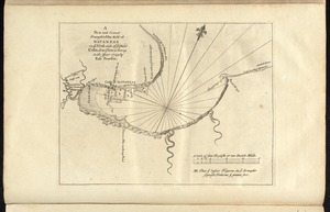
[Chignecto Bay and vicinity]
648.
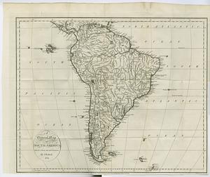
A general map of South America : drawn from the best surveys
649.
Liverpool Bay
650.
A pocket companion of Ireland : containing all the cities, market towns, boroughs, all ye great roads, and principal cross...
651.
The roads of ye south part of Great Britain, called England and Wales : Containing all ye cities, market towns, post towns,...
652.
The Carolina's with part of Georgia
653.
Essex
654.
A map of the West-Indies &c. Mexico or New Spain : also ye trade winds, and ye several tracts made by ye galeons and flota from...
655.
A new chart of the West Indies, drawn from the best Spanish maps, and regulated by astronomical observations ; Plan of the road...
656.
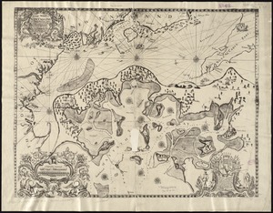
[Chart of the gulf and river of St. Lawrence]
657.
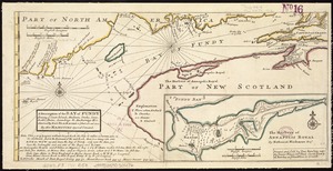
A description of the Bay of Fundy : shewing ye coast, islands, harbours, creeks, coves, rocks & sholes, soundings & anchorings &c
658.
Egmont Harbor
659.
Guadaloupe, one of the Caribbee Islands subject to France in the West Indies
660.
Ireland
‹ Prev
Next ›
1
2
…
29
30
31
32
33
34
35
36
37
…
113
114


![[Chignecto Bay and vicinity]](https://bpldcassets.blob.core.windows.net/derivatives/images/commonwealth:9g54xk66m/image_thumbnail_300.jpg)


![[Chart of the gulf and river of St. Lawrence]](https://bpldcassets.blob.core.windows.net/derivatives/images/commonwealth:7h149v39v/image_thumbnail_300.jpg)