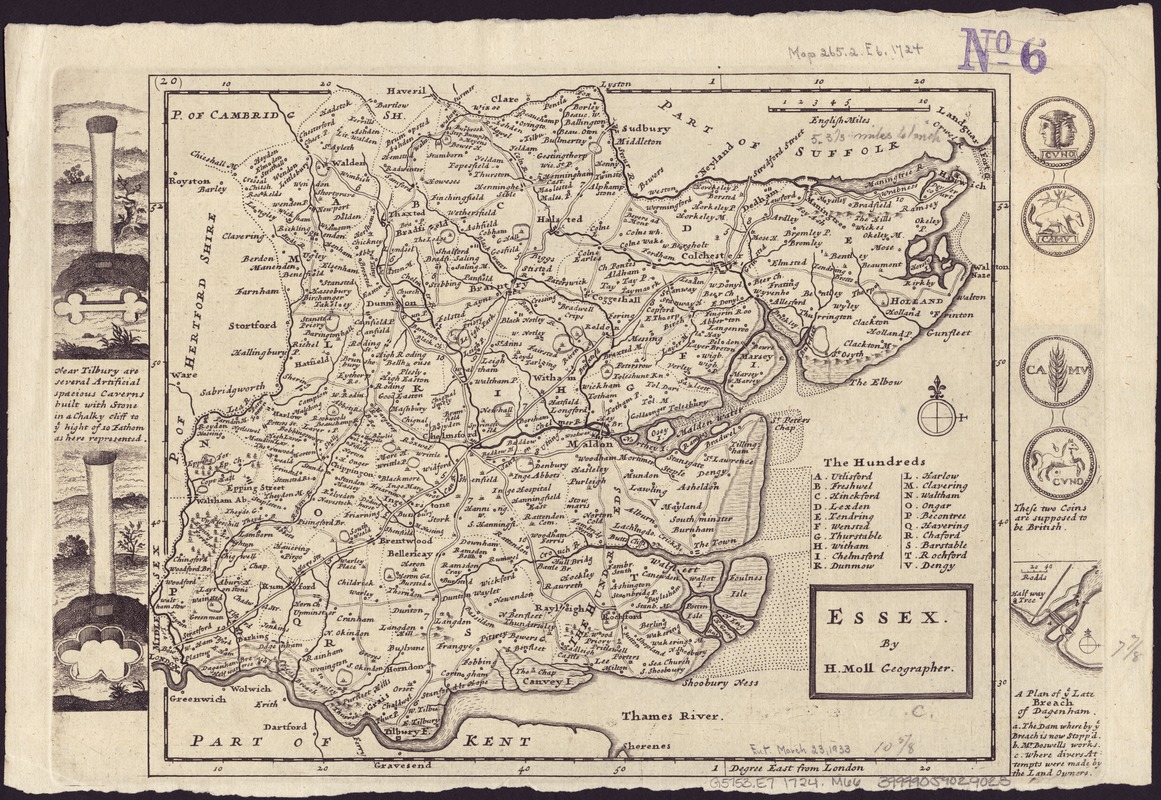
Essex
Item Information
- Title:
- Essex
- Creator:
- Moll, Herman, d. 1732
- Name on Item:
-
by H. Moll.
- Date:
-
[1724]
- Format:
-
Maps/Atlases
- Location:
-
Boston Public Library
Norman B. Leventhal Map & Education Center - Collection (local):
-
Norman B. Leventhal Map & Education Center Collection
- Subjects:
-
Essex (England)--Maps--Early works to 1800
- Places:
-
EnglandEssex (county)
- Extent:
- 1 map ; 22 x 26 cm., on plate 24 x 35 cm.
- Terms of Use:
-
No known copyright restrictions.
No known restrictions on use.
- Publisher:
-
London :
H. Moll
- Scale:
-
Scale [1:335,000].
- Language:
-
English
- Notes:
-
Relief shown pictorially.
Imprint derived from the atlases in which the map was issued.
Engraved pictures of local places of interest and coins, outside neat line to left and right.
Shows boundaries, rivers, roads with distances, parks and settlements.
List of hundreds.
London meridian.
Appears in the author's Set of fifty new and correct maps of England and Wales &c.. London : H. Moll et al., 1724.
County of Essex.
- Notes (date):
-
This date is inferred.
- Identifier:
-
06_01_006980
- Call #:
-
G5753.E7 1724 .M66
- Barcode:
-
39999059029023