A pocket companion of Ireland : containing all the cities, market towns, boroughs, all ye great roads, and principal cross roads with the computed miles from town to town
Item Information
- Title:
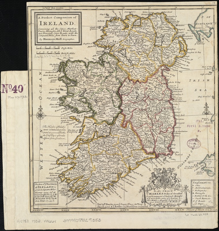
- A pocket companion of Ireland : containing all the cities, market towns, boroughs, all ye great roads, and principal cross roads with the computed miles from town to town
- Creator:
- Moll, Herman, d. 1732
- Name on Item:
-
by Herman Moll, Geographer.
- Date:
-
[1732–1736]
- Format:
-
Maps/Atlases
- Location:
-
Boston Public Library
Norman B. Leventhal Map & Education Center - Collection (local):
-
Norman B. Leventhal Map & Education Center Collection
- Subjects:
-
Roads--Ireland--Maps--Early works to 1800
Ireland--Maps--Early works to 1800
- Places:
-
Ireland
- Extent:
- 1 map : col. ; 29 x 27 cm.
- Terms of Use:
-
No known copyright restrictions.
No known restrictions on use.
- Publisher:
-
[London] :
Sold by T. Bowles ... & I. Bowles ...
- Scale:
-
Scale [ca. 1:1,700,000]
- Language:
-
English
- Notes:
-
Relief shown pictorially.
Includes geographical notes and ornamental cartouche with dedication to Charles Duke of Grafton.
Appears in the author's Atlas Minor. London: Thomas Bowles and John Bowles, [1732 or 1736].
- Notes (date):
-
This date is inferred.
- Identifier:
-
06_01_007051
- Call #:
-
G5780 1732 .M66x
- Barcode:
-
39999059029353


