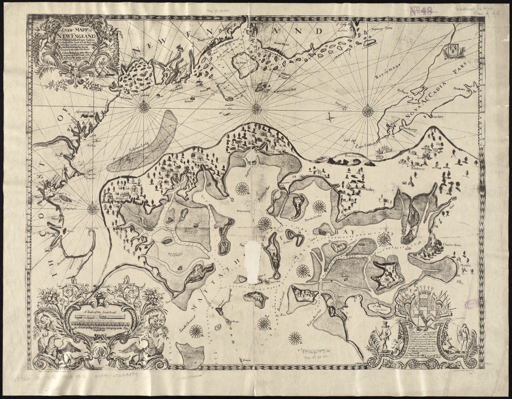
A new mapp of New England from Cape Codd to Cape Sables : describing all the sands, shoals, rocks and difficultyes together with a sand draft of the Mattathussetts Bay
Item Information
- Title:
- A new mapp of New England from Cape Codd to Cape Sables : describing all the sands, shoals, rocks and difficultyes together with a sand draft of the Mattathussetts Bay
- Creator:
- Pound, Thomas.
- Name on Item:
-
exactly surveyed by the author Tho. Pound.
- Date:
-
1912
- Format:
-
Maps/Atlases
- Location:
-
Boston Public Library
Norman B. Leventhal Map & Education Center - Collection (local):
-
Norman B. Leventhal Map & Education Center Collection
- Subjects:
-
Coasts--New England--Maps--Early works to 1800--Facsimiles
Massachusetts Bay (Mass.)--Maps--Early works to 1800--Facsimiles
1691
- Places:
-
New England (area)
MassachusettsMassachusetts Bay
- Extent:
- 2 maps on 1 sheet ; 51 x 64 cm.
- Terms of Use:
-
No known copyright restrictions.
No known restrictions on use.
- Publisher:
-
Boston :
Frederick Lewis Gay
- Scale:
-
Scale not given
Scale [ca. 1:46,000]
- Language:
-
English
- Table of Contents:
-
[New England Coast]
[Massachusetts Bay].
- Notes:
-
Facsimile.
Oriented with north to the upper right.
Relief shown pictorially. Depth shown by soundings.
"Copy 129 1912 by Frederick Lewis Gay."
Originally issued: [London] : Sold by Phillip Lea, 1691.
- Identifier:
-
06_01_008430
- Call #:
-
G3722.C6 1692 .P68 1912
- Barcode:
-
39999065653899


