Toggle navigation
LMEC Home
Exhibitions
Georeferencing
Tools for Teachers
Collections
My Favorites
Sign Up / Log In
Search
Search the map portal
Map Collection
Map Collection
Map Sets
Search
Search
Search for
Search In
All Fields
Creator
Title
Subject
Place
Search All Digital Collections
Advanced Search
145 Results
My Search
Start Over
1893
Remove constraint 1893
Filter your Search
Place
North and Central America
126
United States
106
Massachusetts
38
Maine
17
Europe
15
Hancock (county)
11
Suffolk (county)
11
Boston
10
more
Place
»
Topic
Mount Desert Island (Me.)--Maps
10
Boston (Mass.)--Maps
9
Trails--Maine--Mount Desert Island--Maps
7
Massachusetts--Maps
6
Canada--Boundaries--United States--Maps
5
United States--Boundaries--Canada--Maps
5
United States--Maps
5
British Columbia--Boundaries--Washington (State)--Maps
3
more
Topic
»
Date
Date range begin
–
Date range end
Current results range from
1752
to
1983
View distribution
Creator
Colton, J. H. (Joseph Hutchins), 1800-1893
24
Bates, Waldron.
9
U.S. Lake Survey
9
United States. Congress (53rd, 2nd session : 1893-1894). House
9
Meade, George Gordon, 1815-1872
8
Moore, John Bassett, 1860-1947
8
Bartholomew, John, 1831-1893
7
Lange, Henry, 1821-1893
7
more
Creator
»
Format
Maps/Atlases
144
Manuscripts
1
Prints
1
Georeferenced
Yes
23
No
122
Collection
Norman B. Leventhal Map & Education Center Collection
135
Boston and New England Maps
45
Urban Maps
35
Maritime Charts and Atlases
10
Robert E. Diefenbach Map Collection at Phillips Academy
5
David Judkins Weaver Papers
2
Massachusetts Real Estate Atlases
2
American Revolutionary War-Era Maps
1
more
Collection
»
Available to use
No known restrictions
140
Creative Commons license
2
Search Constraints
Sort by relevance
relevance
title
date (asc)
date (desc)
Number of results to display per page
20 per page
10
per page
20
per page
50
per page
100
per page
View results as:
grid view
map view
Search Results
41.
Colton's plans of U.S. harbors : showing the position & vicinities of the most important fortifications on the sea-board and in...
42.
Colton's rail road and county map of the Southern States containing the latest information
43.
Delaware and Maryland
44.
Ireland, from the best authorities : with distances in miles from Dublin
45.
J.H. Colton's topographical map of North and South Carolina : a large portion of Georgia & part of adjoining states
46.
J.H. Colton's Topographical map of seat of war in Virginia, Maryland, &c
47.
Maine
48.
Map of the United States, the British provinces, Mexico, &c : showing the routes of the U.S. Mail steam packets to California,...
49.
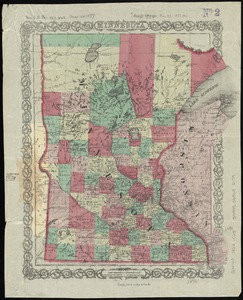
Minnesota
50.
New Hampshire
51.
P. McD. Collins' proposed overland telegraph : via Behrings Strait and asiatic Russia to Europe, under Russian & British grants
52.
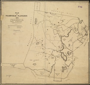
Plan of Framingham Plantation 1699
53.
Railway map of the British Isles
54.
W.H. Smith & Son's new railway map of the British Isles
55.
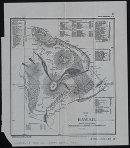
Map of Hawaii
56.
Frankreich
57.
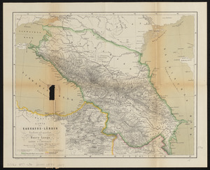
Karte der Kaukasus-Länder
58.
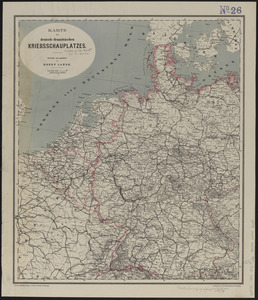
Karte des deutsch-französischen kriegsschauplatzes
59.
Preussen, der Norddeutsche bund und Dänemark
60.
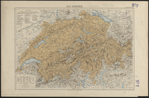
Die Schweiz
‹ Prev
Next ›
1
2
3
4
5
6
7
8