Ireland, from the best authorities : with distances in miles from Dublin
Item Information
- Title:
- Ireland, from the best authorities : with distances in miles from Dublin
- Description:
-
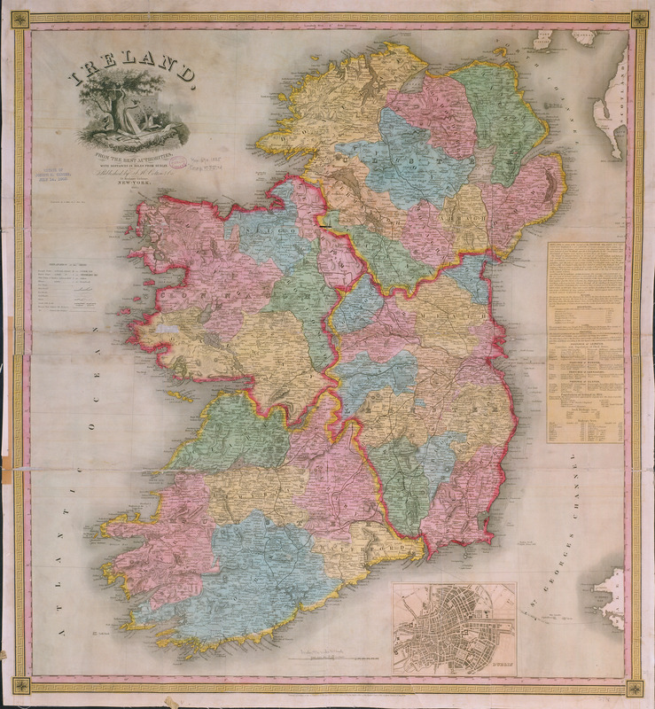
Published by one of America's leading atlas publishers ten years before Ireland's potato famine, this map depicts a country blossoming with population growth and urban development. A sidebar lists the population of the major towns in each province. Dublin was, by far, the most populous city, with over 250,000 residents, while the second largest, Limerick, was only one quarter of Dublin's size. The total population of Ireland at this point was nearly eight million. There is no evidence on this map of the famine which struck in 1845. By 1851, the population had been reduced by two million due to a combination of starvation, disease, and immigration.
- Creator:
- Colton, J. H. (Joseph Hutchins), 1800-1893
- Name on Item:
-
Joseph H. Colton
- Date:
-
1835
- Format:
-
Maps/Atlases
- Location:
-
Boston Public Library
Norman B. Leventhal Map & Education Center - Collection (local):
-
Norman B. Leventhal Map & Education Center Collection
- Subjects:
-
Ireland--Maps
- Places:
-
Ireland
- Extent:
- 1 map : col. ; 74 x 79 cm.
- Terms of Use:
-
No known copyright restrictions.
No known restrictions on use.
- Publisher:
-
New York :
J.H. Colton & Co.
- Scale:
-
Scale [ca. 1:601,920]
- Language:
-
English
- Notes:
-
Relief shown by shading and hachures.
Exhibited in “Faces and Places,” at the Boston Public Library, Boston, MA, October 2003 - September 2004.
- Identifier:
-
05_04_000038
- Call #:
-
G5780 1835 .C6
- Barcode:
-
39999065649566


