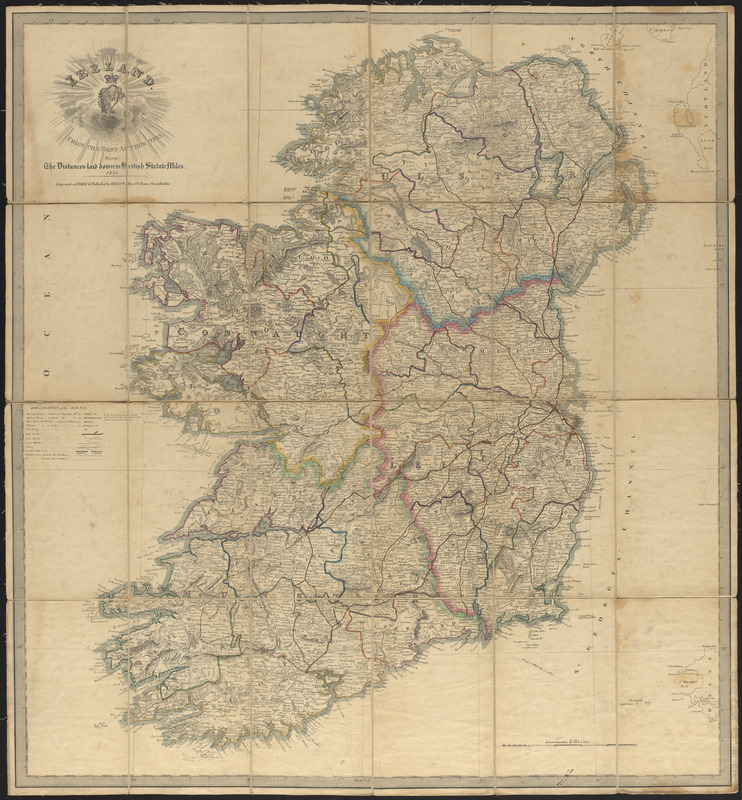
Ireland : from the best authorities, with the distances laid down in British statute miles
Item Information
- Title:
- Ireland : from the best authorities, with the distances laid down in British statute miles
- Publisher:
- M. H. & J. W. Allen (Firm)
- Date:
-
1834
- Format:
-
Maps/Atlases
- Location:
-
Boston Public Library
Norman B. Leventhal Map & Education Center - Collection (local):
-
Norman B. Leventhal Map & Education Center Collection
- Subjects:
-
Ireland--Maps
- Places:
-
Ireland
- Extent:
- 1 map in 24 panels mounted on linen : hand colored ; 76 x 70 cm
- Terms of Use:
-
No known copyright restrictions.
No known restrictions on use.
- Publisher:
-
Dublin :
M.H. & J.W. Allen
- Scale:
-
Scale approximately 1:600,000
- Language:
-
English
- Notes:
-
Relief shown by hachures.
- Identifier:
-
06_01_015033
- Call #:
-
G5780 1834 .I74
- Barcode:
-
39999065708107


