Toggle navigation
LMEC Home
Exhibitions
Georeferencing
Tools for Teachers
Collections
My Favorites
Sign Up / Log In
Search
Search the map portal
Map Collection
Map Collection
Map Sets
Search
Search
Search for
Search In
All Fields
Creator
Title
Subject
Place
Search All Digital Collections
Advanced Search
585 Results
My Search
Start Over
East Boston
Remove constraint East Boston
Filter your Search
Place
North and Central America
409
United States
334
Massachusetts
151
Suffolk (county)
129
Boston
125
Asia
63
Europe
47
Canada
42
more
Place
»
Topic
Boston (Mass.)--Maps
71
East Boston (Boston, Mass.)--Maps
36
United States--Maps
16
Real property--Massachusetts--Boston--Maps
15
Middle East--Maps
14
City planning--Massachusetts--Boston--Maps
12
Coasts--Newfoundland and Labrador--Maps
11
Urban renewal--Massachusetts--Boston--Maps
11
more
Topic
»
Date
Date range begin
–
Date range end
Current results range from
1482
to
2023
View distribution
Creator
United States. Hydrographic Office
55
Boston Redevelopment Authority
14
Des Barres, Joseph F. W. (Joseph Frederick Wallet), 1722-1824
12
Ptolemy, 2nd cent
11
Boston (Mass.). Engineering Dept
10
Boynton, George W., d. 1884
10
Moll, Herman, d. 1732
10
O.H. Bailey & Co
10
more
Creator
»
Format
Maps/Atlases
579
Manuscripts
13
Drawings/Illustrations
3
Prints
3
Books
1
Georeferenced
Yes
74
No
511
Collection
Norman B. Leventhal Map & Education Center Collection
540
Boston and New England Maps
172
Urban Maps
163
Maritime Charts and Atlases
103
American Revolutionary War-Era Maps
65
Mapping Boston Collection
20
Boston Redevelopment Authority Collection
18
American Textile History Museum Image Collection
6
more
Collection
»
Available to use
No known restrictions
543
Creative Commons license
29
Search Constraints
Sort by relevance
relevance
title
date (asc)
date (desc)
Number of results to display per page
20 per page
10
per page
20
per page
50
per page
100
per page
View results as:
grid view
map view
Search Results
541.
États Unis
542.
Indian Ocean
543.
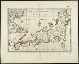
A mapp of the Isles of Iapon
544.
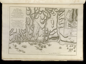
Plan of the attack against Basseterre on the island of Guadeloupe by a squadron of his Majesty's ships of war commanded by...
545.
Post route map of the states of New Hampshire, Vermont, Massachusetts, Rhode Island, Connecticut, and parts of New York and Maine
546.
An improved map of the United States
547.
A mapp of New England
548.
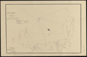
Ontario 1819
549.
Tractus regni Angliae septentrion[alis] in quo ducatus Eboracensis, episcopatus Dunelmensis, comitatus Northumbriae, Cumbriae,...
550.
An exact mapp of New England and New York
551.
Colton's new topographical map of the eastern portion of the State of North Carolina with part of Virginia & South Carolina...
552.
Central Virginia showing Lieut. Gen'l. U.S. Grant's Campaign and marches of the armies under his command in 1864-65
553.
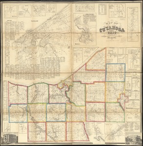
Map of Cuyahoga County, Ohio
554.
New Hampshire by recent survey : made under the supreme authority and published according to law
555.
Index chart of natural oyster bars, crab bottoms, clam bars and triangulation stations of Maryland surveyed by Maryland Shell...
556.
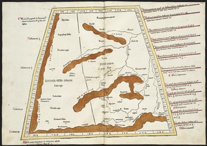
Octava Asiae tabula
557.
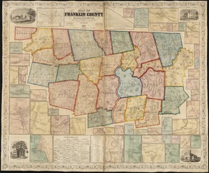
Map of Franklin County, Massachusetts : based upon the trigonometrical survey of the state
558.
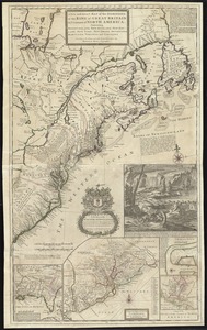
A new and exact map of the dominions of the King of Great Britain on ye continent of North America : containing Newfoundland,...
559.
A map of the inhabited part of Canada from the French surveys : with the frontiers of New York and New England from the large...
560.
Octava Asie tabula continet Scythiam que citra Imaū est & seras
‹ Prev
Next ›
1
2
…
24
25
26
27
28
29
30


![Tractus regni Angliae septentrion[alis] in quo ducatus Eboracensis, episcopatus Dunelmensis, comitatus Northumbriae, Cumbriae, Westmoriae et Lancastriae cum Mona insula](https://bpldcassets.blob.core.windows.net/derivatives/images/commonwealth:cj82kr11k/image_thumbnail_300.jpg)