An exact mapp of New England and New York
Item Information
- Title:
- An exact mapp of New England and New York
- Description:
-
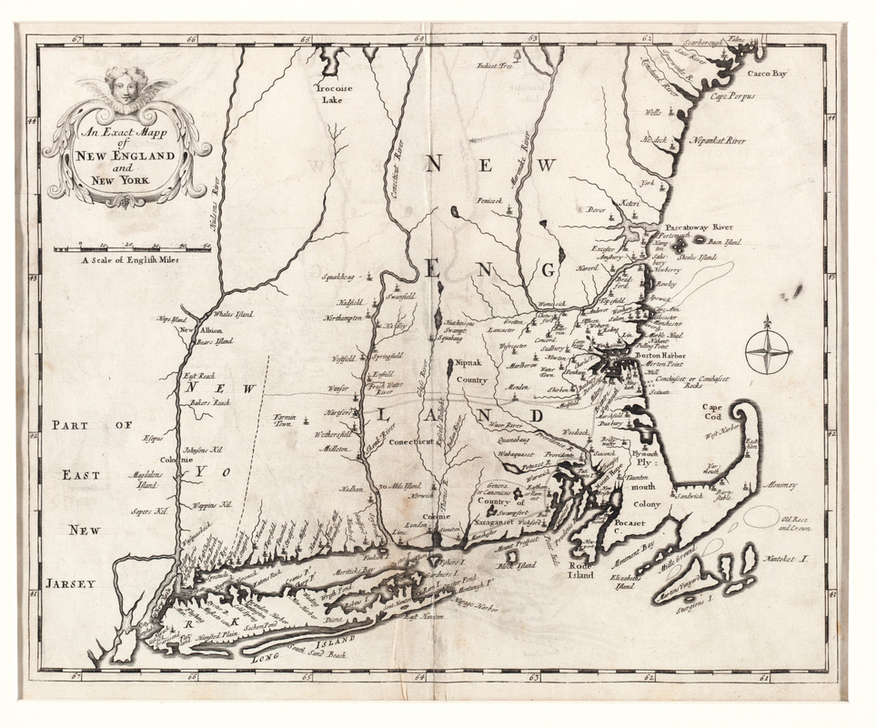
Recognized as the first 18th century map of New England, this map was used to illustrate Cotton Mather's famous history of the Bay Colony, "Magnalia Christi Americana: or the Ecclesiastical History of New England from Its First Planting". The map provided little new geographic information, since it was based on an earlier printed map -- Thornton, Morden, and Lea's 1685 map of New England. Mather's history of the settlement of New England is one of the most interesting and valuable sources for the study of life in early colonial New England. It is generally considered to be America's most famous 18th-century book.
- Creator:
- Mather, Cotton, 1663-1728
- Name on Item:
-
[Cotton Mather]
- Date:
-
1702
- Format:
-
Maps/Atlases
- Location:
- Private Collection
- Collection (local):
-
Mapping Boston Collection
- Subjects:
-
Ecclesiastical geography--New England--Maps--Early works to 1800
Ecclesiastical geography--New York (State)--Maps--Early works to 1800
New England--Church history--Maps--Early works to 1800
New York (State)--Church history--Maps--Early works to 1800
- Places:
-
New England (area)
New York
- Extent:
- 1 map ; 31 x 37 cm.
- Terms of Use:
-
No known copyright restrictions.
This work is licensed for use under a Creative Commons Attribution Non-Commercial Share Alike License (CC BY-NC-SA).

- Publisher:
-
London :
Printed for Thomas Parkhurst
- Scale:
-
Scale [ca. 1:1,550,000]
- Language:
-
English
- Notes:
-
Covers area from the Hudson River Valley east to Cape Cod and from Long Island north to Casco Bay.
Appears in Mather's Magnalia Christi Americana. London. 1702.
Mather made reference to the map in his book, as either "An ecclesiastical map of the country" or "A map of the country" showing colonies, counties, and congregations.
- Identifier:
-
05_04_000056
- Barcode:
-
39999052507538


