Toggle navigation
LMEC Home
Exhibitions
Georeferencing
Tools for Teachers
Collections
My Favorites
Sign Up / Log In
Search
Search the map portal
Map Collection
Map Collection
Map Sets
Search
Search
Search for
Search In
All Fields
Creator
Title
Subject
Place
Search All Digital Collections
Advanced Search
13385 Results
My Search
Start Over
Date facet yearly ssim
1860
to
1869
Remove constraint Date facet yearly ssim: <span class='from'>1860</span> to <span class='to'>1869</span>
Filter your Search
Place
North and Central America
10,111
United States
8,249
Massachusetts
2,691
Suffolk (county)
1,664
Boston
1,621
Europe
1,386
Canada
949
New York
640
more
Place
»
Topic
Boston (Mass.)--Maps
741
City planning--Massachusetts--Boston--Maps
418
United States--History--Revolution, 1775-1783--Maps
329
United States--Maps
315
Urban renewal--Massachusetts--Boston--Maps
254
Real property--Massachusetts--Boston--Maps
252
Massachusetts--Maps
219
Insurance surveys
197
more
Topic
»
Date
Date range begin
–
Date range end
Current results range from
1482
to
2023
View distribution
Creator
United States. Hydrographic Office
595
Boston Redevelopment Authority
403
Des Barres, Joseph F. W. (Joseph Frederick Wallet), 1722-1824
247
Royal United Services Institute for Defence and Security Studies
160
Jefferys, Thomas, -1771
154
George, III, King of Great Britain, 1738-1820
152
George, IV, King of Great Britain, 1762-1830
151
O.H. Bailey & Co
148
more
Creator
»
Format
Maps/Atlases
13,205
Manuscripts
985
Prints
102
Books
49
Drawings/Illustrations
44
Photographs
15
Objects/Artifacts
13
Documents
7
more
Format
»
Georeferenced
Yes
979
No
12,406
Collection
Norman B. Leventhal Map & Education Center Collection
8,891
American Revolutionary War-Era Maps
3,305
Boston and New England Maps
2,804
Urban Maps
2,397
Maritime Charts and Atlases
1,150
William L. Clements Library Collection
910
Library of Congress Collection
618
Boston Redevelopment Authority Collection
475
more
Collection
»
Available to use
No known restrictions
9,952
Creative Commons license
1,677
Search Constraints
Sort by relevance
relevance
title
date (asc)
date (desc)
Number of results to display per page
20 per page
10
per page
20
per page
50
per page
100
per page
View results as:
grid view
map view
Search Results
5241.
Map of part of Nipon Island
5242.
A map of part of Pennsylvania & Maryland intended to shew, at one view, the several places ...
5243.
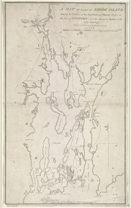
A map of part of Rhode Island shewing the positions of the American and British armies at the Siege of Newport, and the...
5244.
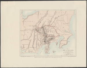
Map of part of the city of Washington shewing the situation of the mansion house, grave yard & buildings belonging to Mr....
5245.
Map of part of the continent of North America : whereon is laid down the Missouri, Jeffersons, Lewis's, Clarks, and the...
5246.
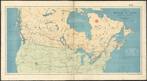
Map of part of the Dominion of Canada, shewing location of some of the principal products, also railway & water routes
5247.
A map of part of the Isthmus of Darien : shewing the communication with Panama, from Portobello & Chagre both by land, and by...
5248.
Map of part of the North West Territory, including the province of Manitoba : shewing an approximate classification of the lands
5249.
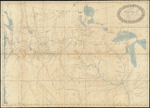
A map of part of the N:W: Territory of the United States : compiled from actual surveys, and the best information
5250.
A map of part of the province of Jersey
5251.
A map of part of the Viceroyalty of Buenos Ayres 1806
5252.
Map of part of Virginia, Maryland and Delaware from the best authorities
5253.
A map of part of West Florida done under the direction of the honourable John Stuart esqr: & by him humbly inscribed to his...
5254.
Map of parts of Boston Harbor and its tributaries
5255.
Map of parts of Essex & part of Middlesex counties, showing the rail road routes between Salem, Lowell, Boston & Lawrence
5256.
Map of parts of Middlesex & Essex counties showing the rail road routes between Salem, Lowell, Boston & Methuen
5257.
Map of parts of Middlesex & Essex counties, showing the rail road routes between Salem, Lowell, Boston & Methuen
5258.
[Map of parts of Pennsylvania, New York and New Jersey]
5259.
[Map of parts of Venezuela and Colombia]
5260.
A map of Pennsylvania exhibiting not only the improved parts of that Province, but also its extensive frontiers : laid down...
‹ Prev
Next ›
1
2
…
259
260
261
262
263
264
265
266
267
…
669
670


![[Map of parts of Pennsylvania, New York and New Jersey]](https://bpldcassets.blob.core.windows.net/derivatives/images/commonwealth:6108vt40m/image_thumbnail_300.jpg)
![[Map of parts of Venezuela and Colombia]](https://bpldcassets.blob.core.windows.net/derivatives/images/commonwealth:4m90fm18q/image_thumbnail_300.jpg)
