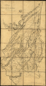
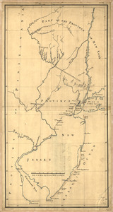
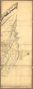
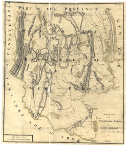
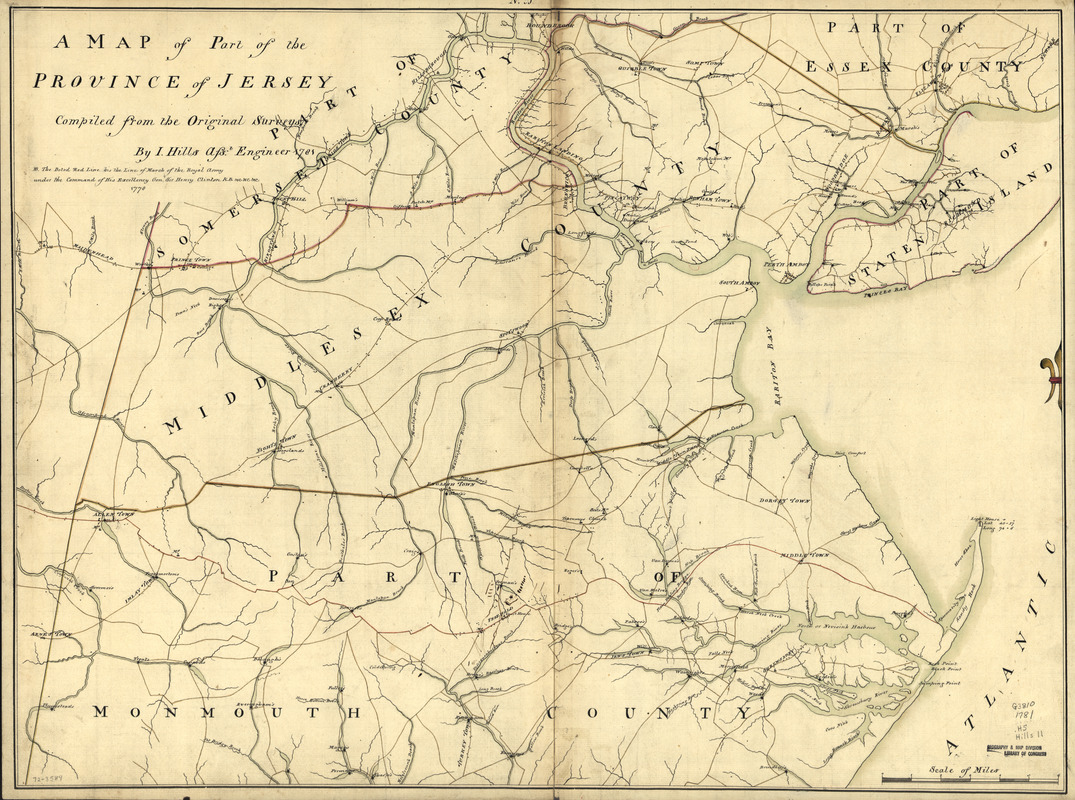
A map of part of the province of Jersey
This map is also available in American Revolutionary Geographies Online (ARGO), a collections portal especially built for material relating to the American Revolutionary War Era. Visit ARGO to learn more about this item and explore the historical geography of North America in the late eighteenth century.
Item Information
- Title:
- A map of part of the province of Jersey
- Creator:
- Hills, John, (Surveyor)
- Contributor:
- Morgan, Benjamin, (Draftsman)
- Name on Item:
-
Compiled from the original surveys by I. Hills, asst. engineer, 1781
- Date:
-
[1781]
- Format:
-
Maps/Atlases
Manuscripts
- Location:
- Library of Congress Geography and Map Division
- Collection (local):
-
Library of Congress Collection
- Subjects:
-
New Jersey--Maps, Manuscript--Early works to 1800
- Places:
-
New Jersey
- Extent:
- 1 manuscript map : hand color; 51 x 69 cm.
- Terms of Use:
-
No known copyright restrictions.
This work is licensed for use under a Creative Commons Attribution Non-Commercial Share Alike License (CC BY-NC-SA).

- Scale:
-
Scale ca. 1:85,000
- Language:
-
English
- Catalog Record:
-
https://lccn.loc.gov/gm72003589
- Notes:
-
Title from table of contents: A survey of part of the province of New Jersey contain[in]g part of Middlesex County, and part of Monmouth, Somerset, and Essex counties with part of Statten [sic] Island in the province of New York. By Morgan, Williams, Dennis, Rue, Dunham, Taylor, Skinner, &c.
Manuscript, pen-and-ink and watercolor.
Has watermarks.
"N.B. The doted red line his [sic] the line of march of the royal army under the command of His Excellency Genl. Sir Henry Clinton, K.B., &c &c. &c., 1778."
- Notes (date):
-
This date is inferred.
- Notes (citation):
-
LC Maps of North America, 1750-1789, 1254
- Identifier:
-
ar125400