Toggle navigation
LMEC Home
Exhibitions
Georeferencing
Tools for Teachers
Collections
My Favorites
Sign Up / Log In
Search
Search the map portal
Map Collection
Map Collection
Map Sets
Search
Search
Search for
Search In
All Fields
Creator
Title
Subject
Place
Search All Digital Collections
Advanced Search
56 Results
My Search
Start Over
Date
1927
Remove constraint Date: <span class='single'>1927</span>
Filter your Search
Place
North and Central America
48
United States
47
Massachusetts
13
Boston
8
Suffolk (county)
8
New England
5
Canada
4
Essex (county)
4
more
Place
»
Topic
Boston (Mass.)--Maps
4
Fire risk assessment
4
Insurance surveys
4
Textile factories
4
New England--Maps--Early works to 1800--Facsimiles
3
Brookline (Mass.)--Maps
2
Cotton manufacture
2
Landowners--Massachusetts--Brookline--Maps
2
more
Topic
»
Date
1927
[remove]
56
Date range begin
–
Date range end
Current results range from
1770
to
1999
1927
to
1927
56
Creator
Geological Survey (U.S.)
8
Associated Factory Mutual Fire Insurance Companies
3
Good, L. S.
3
United States. Forest Service
3
Bromley, George Washington
2
Bromley, Walter Scott
2
G.W. Bromley & Co.
2
McConnell, H. P.
2
more
Creator
»
Format
Maps/Atlases
55
Photographs
1
Georeferenced
Yes
1
No
55
Collection
Norman B. Leventhal Map & Education Center Collection
47
Boston and New England Maps
9
American Textile History Museum Image Collection
4
Urban Maps
4
Massachusetts Real Estate Atlases
2
American Revolutionary War-Era Maps
1
Campus Maps from Phillips Academy Archives and Special Collections
1
David Judkins Weaver Papers
1
more
Collection
»
Available to use
No known restrictions
44
Creative Commons license
4
Search Constraints
Sort by relevance
relevance
title
date (asc)
date (desc)
Number of results to display per page
20 per page
10
per page
20
per page
50
per page
100
per page
View results as:
grid view
map view
Search Results
21.
Map of Cape Town central and neighbouring suburbs
22.
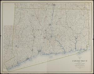
Map of Connecticut
23.
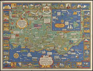
A map of Honolulu and the Sandwich Islands which we now call the Hawaiian Islands
24.
A map of New England and New York
25.
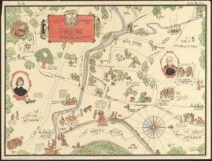
The map of pioneer Hartford : founded 1636, incorporated 1784, showing early landmarks and the locations of historical events
26.
Map of the Back Bay Fens showing the public ways bordering and crossing them and the neighboring newly laid out parts of...
27.
Map of the Boston Elevated Ry. 1927
28.
Map of the Canadian Rockies triangle tour of British Columbia, Alaska and the Yukon
29.
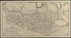
Map of the city of Somerville 1927
30.
A mapp of New England
31.
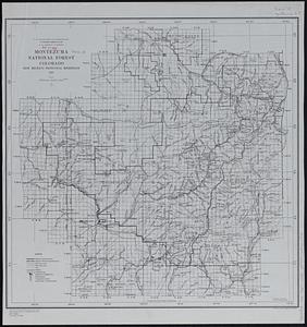
Montezuma National Forest, Colorado
32.
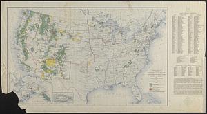
National forests, state forests, national parks, national monuments and Indian reservations
33.
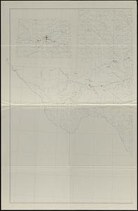
Oil and gas fields of the state of Texas
34.
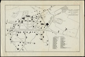
Phillips Academy, Andover, Massachusetts, map of property
35.
Pilot chart of New York Bay and Harbor for use with Krause's New York pilot courses
36.
Plan de Paris
37.
Plan of a part of Beverly in the Colony of the Massachusetts Bay
38.
Plan of corner of Centry & Beacon St's -- 1741
39.
Plan of the burnt district : showing proposed improvements in streets. Nov. 12th 1872
40.
A plan of the town of Walpole taken by an actual survey in the month of October 1794 and layed down from a scale of 200 rods to...
‹ Prev
Next ›
1
2
3