Map of the Canadian Rockies triangle tour of British Columbia, Alaska and the Yukon

Item Information
- Title:
- Map of the Canadian Rockies triangle tour of British Columbia, Alaska and the Yukon
- Title (alt.):
-
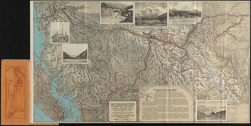
Triangle tour of British Columbia Jasper National Park, Mount Robson Park, Canadian Rockies and the scenic seas of the North Pacific Coast
Routes of Canadian National Pacific Coast services, Canadian National Steamship Company Ltd.
- Publisher:
- Canadian National Railways
- Name on Item:
-
Canadian National
- Date:
-
[1927]
- Format:
-
Maps/Atlases
- Location:
-
Boston Public Library
Norman B. Leventhal Map & Education Center - Collection (local):
-
Norman B. Leventhal Map & Education Center Collection
- Subjects:
-
British Columbia--Maps
Railroads--British Columbia--Maps
Railroads--Alberta--Maps
Railroads--Yukon--Maps
Steamboat lines--British Columbia--Maps
Steamboat lines--Alaska--Maps
Canadian National Railways
- Places:
-
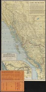
Alaska
CanadaProvince of Alberta (province)
CanadaProvince of British Columbia (province)
CanadaYukon Territory (territory)
- Extent:
- 2 maps on 1 sheet : both sides, color ; 43 x 76 cm and 74 x 42 cm, on sheet 77 x 43 cm, folded in cover 24 x 10 cm
- Terms of Use:
-
No known copyright restrictions.
No known restrictions on use.
- Publisher:
-
[Canada] :
Canadian National Railways
- Scale:
-
Scale approximately 1:1,500,000
Scale varies
- Language:
-
English
- Table of Contents:
-
The triangle tour of British Columbia, Jasper National Park, Mount Robson Park, Canadian Rockies, and the scenic seas of the North Pacific coast
Routes of Canadian National Pacific Coast services, Canadian National Steamship Company Ltd.
- Notes:
-
Relief shown by shading and spot heights.
Cover title.
Includes illustrations, text, and inset.
Map of "Canadian National Railways Grand Trunk Railway System" on page [2] of cover.
"5271 10-19-27."
- Notes (date):
-
This date is inferred.
- Identifier:
-
06_01_017159A
06_01_017159B
- Call #:
-
G3511.P3 1927 .C36
- Barcode:
-
39999085955290


