Toggle navigation
LMEC Home
Exhibitions
Georeferencing
Tools for Teachers
Collections
My Favorites
Sign Up / Log In
Search
Search the map portal
Map Collection
Map Collection
Map Sets
Search
Search
Search for
Search In
All Fields
Creator
Title
Subject
Place
Search All Digital Collections
Advanced Search
443 Results
My Search
Start Over
virginia
Remove constraint virginia
Filter your Search
Place
North and Central America
431
United States
380
Virginia
233
Maryland
54
West Virginia
42
Middle Atlantic
38
North Carolina
34
York (county)
32
more
Place
»
Topic
Virginia--Maps
48
Virginia--Maps--Early works to 1800
39
Virginia--History--Civil War, 1861-1865--Maps
34
United States--History--Revolution, 1775-1783--Maps
32
United States--History--Civil War, 1861-1865--Maps
27
North America--Maps--Early works to 1800
24
Maryland--Maps
21
West Virginia--Maps
19
more
Topic
»
Date
Date range begin
–
Date range end
Current results range from
1590
to
1995
View distribution
Creator
Jefferys, Thomas, -1771
15
Michler, N. (Nathaniel), 1827-1881
15
Evans, Lewis, 1700?-1756
14
United States. Army. Corps of Engineers
13
Weyss, J. E.
12
New York Lithographing, Engraving and Printing Co.
11
Strasser, J.
11
Theilkuhl, F.
11
more
Creator
»
Format
Maps/Atlases
440
Manuscripts
47
Prints
2
Objects/Artifacts
1
Georeferenced
Yes
48
No
395
Collection
Norman B. Leventhal Map & Education Center Collection
286
American Revolutionary War-Era Maps
181
William L. Clements Library Collection
40
Library of Congress Collection
24
MacLean Collection Map Library
24
Maritime Charts and Atlases
18
David Judkins Weaver Papers
17
Richard H. Brown Revolutionary War Map Collection at Mount Vernon
15
more
Collection
»
Available to use
No known restrictions
283
Creative Commons license
76
Search Constraints
Sort by relevance
relevance
title
date (asc)
date (desc)
Number of results to display per page
20 per page
10
per page
20
per page
50
per page
100
per page
View results as:
grid view
map view
Search Results
281.
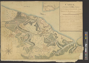
Amérique Septentrionale, Yorck : reconnoissance des ouvrages de cette ville ave le tracé des attaques dirigées contre eux
282.
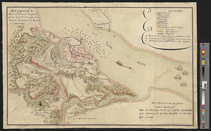
Attaque de la ville d'York en Virginie prise le 19 8bre 1781 par les armées combinées de France et d'Amérique
283.
The battle fields and military positions in the Virginian peninsula : from surveys supplied by officers of the army
284.
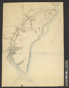
The British works at Yorktown and Gloucester
285.
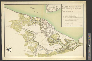
Carte des environs de York en Virginie avec les attaques et la position des armées Françoise et Américaine, devant cette place...
286.
Carte des environs de York en Virginie avec les attaques et la position des armées Françoise et Américaine devant cette place...
287.
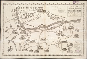
Map of the battle ground of Greenbrier River
288.
Official plan of the siege of Yorktown, Va. conducted by the Army of the Potomac under command of Maj. Gen. George B....
289.
Plan du siége d'York par l'armée combinée commandée par les generaux Washington et Cte. de Rochambeau
290.
A plan of the disposition of the advanced party, consisting of 400 men
291.
A plan of the encampment of the detachment from the Little Meadows
292.
A plan of the line of march of the detachment from the Little Meadows
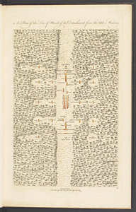
293.
A plan of the line of march with the whole baggage
294.
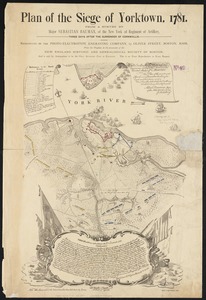
Plan of the Siege of Yorktown, 1781
295.
Portsmouth
296.
Portsmouth and Norfolk
297.
Position of the troops under Earl Cornwallis on the 28 and 29th September 1781; when the enemy first appeared
298.
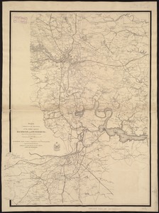
Region embraced in the operations of the armies against Richmond and Petersburg
299.
Region embraced in the operations of the armies against Richmond and Petersburg
300.
Richmond Petersburg and vicinity
‹ Prev
Next ›
1
2
…
11
12
13
14
15
16
17
18
19
…
22
23