Toggle navigation
LMEC Home
Exhibitions
Georeferencing
Tools for Teachers
Collections
My Favorites
Sign Up / Log In
Search
Search the map portal
Map Collection
Map Collection
Map Sets
Search
Search
Search for
Search In
All Fields
Creator
Title
Subject
Place
Search All Digital Collections
Advanced Search
1485 Results
My Search
Start Over
Subject
"Boston (Mass.)--Maps"
Remove constraint Subject: "Boston (Mass.)--Maps"
Filter your Search
Place
North and Central America
1,484
United States
1,482
Suffolk (county)
1,400
Boston
1,396
Massachusetts
1,100
Boston Harbor
126
Roxbury
91
Charlestown
71
more
Place
»
Topic
Boston (Mass.)--Maps
748
City planning--Massachusetts--Boston--Maps
407
Real property--Massachusetts--Boston--Maps
245
Urban renewal--Massachusetts--Boston--Maps
245
Landowners--Massachusetts--Boston--Maps
161
Buildings--Massachusetts--Boston--Maps
124
Land use--Massachusetts--Boston--Maps
99
Roxbury (Boston, Mass.)--Maps
90
more
Topic
»
Date
Date range begin
–
Date range end
Current results range from
1689
to
2023
View distribution
Creator
Boston Redevelopment Authority
387
Bromley, George Washington
69
Bromley, Walter Scott
68
G.W. Bromley & Co.
46
Geo. H. Walker & Co
28
Boston (Mass.). Engineering Dept
21
Boynton, George W., d. 1884
21
Sampson, Davenport & Co
21
more
Creator
»
Format
Maps/Atlases
1,482
Manuscripts
50
Drawings/Illustrations
5
Posters
1
Prints
1
Georeferenced
Yes
140
No
1,345
Collection
Boston and New England Maps
1,209
Urban Maps
1,016
Norman B. Leventhal Map & Education Center Collection
1,004
Boston Redevelopment Authority Collection
449
American Revolutionary War-Era Maps
129
Mapping Boston Collection
53
Massachusetts Real Estate Atlases
38
Maritime Charts and Atlases
28
more
Collection
»
Available to use
No known restrictions
1,302
Creative Commons license
116
Search Constraints
Sort by relevance
relevance
title
date (asc)
date (desc)
Number of results to display per page
20 per page
10
per page
20
per page
50
per page
100
per page
View results as:
grid view
map view
Search Results
281.
Map of the city and vicinity of Boston, Massachusetts
282.
Map of West Roxbury
283.
New map of the vicinity of Boston, with the dates of settlement, population in 1840, and distance from the capital
284.
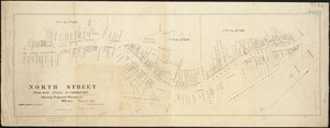
North Street from near Cross, to Commercial : showing proposed widening to 50 feet
285.
A plan of a survey of Noddles Island
286.
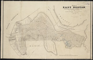
Plan of East Boston
287.
Plan of East Boston : exhibiting the land & water lots and other improvements
288.
Plan of South Boston
289.
Plan of the town of West Roxbury : compiled from various plans and surveys, by order of the selectmen
290.
Road map, drawn & engraved expressly for Road book of Boston & vicinity
291.
South Boston
292.
Map of Boston Harbor
293.
Map of the principal part of Boston, and adjacent cities, for 1873
294.
Plan of burnt district by fire of Nov. 9th and 10th, 1872 : showing street improvements as adopted by Board of Street...
295.
Plan of burnt district, by fire of Nov. 9th and 10th 1872 : showing street improvements as adopted by Board of Street...
296.
Plan of the burnt district : showing proposed improvements in streets. Nov. 12th 1872
297.
Russell's map of Boston from the latest surveys : colored to show the burned district of the Great Fire Nov 9th & 10th 1872
298.
Back Bay park
299.
Brighton and Allston urban design strategy
300.
Insurance maps of Boston volume two
‹ Prev
Next ›
1
2
…
11
12
13
14
15
16
17
18
19
…
74
75