Toggle navigation
LMEC Home
Exhibitions
Georeferencing
Tools for Teachers
Collections
My Favorites
Sign Up / Log In
Search
Search the map portal
Map Collection
Map Collection
Map Sets
Search
Search
Search for
Search In
All Fields
Creator
Title
Subject
Place
Search All Digital Collections
Advanced Search
14164 Results
Filter your Search
Place
North and Central America
10,832
United States
8,868
Massachusetts
2,832
Suffolk (county)
1,688
Boston
1,644
Europe
1,428
Canada
1,010
New York
684
more
Place
»
Topic
Boston (Mass.)--Maps
753
City planning--Massachusetts--Boston--Maps
419
United States--History--Revolution, 1775-1783--Maps
331
United States--Maps
331
Real property--Massachusetts--Boston--Maps
254
Urban renewal--Massachusetts--Boston--Maps
254
North America--Maps--Early works to 1800
241
Massachusetts--Maps
236
more
Topic
»
Date
Date range begin
–
Date range end
Current results range from
1482
to
2023
View distribution
Creator
United States. Hydrographic Office
597
Boston Redevelopment Authority
404
Des Barres, Joseph F. W. (Joseph Frederick Wallet), 1722-1824
247
Jefferys, Thomas, -1771
172
United States. National Ocean Service
170
Royal United Services Institute for Defence and Security Studies
160
George, III, King of Great Britain, 1738-1820
152
George, IV, King of Great Britain, 1762-1830
151
more
Creator
»
Format
Maps/Atlases
13,978
Manuscripts
985
Prints
102
Books
53
Drawings/Illustrations
44
Photographs
15
Objects/Artifacts
13
Documents
7
more
Format
»
Georeferenced
Yes
979
No
13,185
Collection
Norman B. Leventhal Map & Education Center Collection
9,162
American Revolutionary War-Era Maps
3,629
Boston and New England Maps
2,936
Urban Maps
2,511
Maritime Charts and Atlases
1,169
William L. Clements Library Collection
910
Library of Congress Collection
618
Boston Redevelopment Authority Collection
475
more
Collection
»
Available to use
No known restrictions
10,408
Creative Commons license
1,678
Search Constraints
Sort by relevance
relevance
title
date (asc)
date (desc)
Number of results to display per page
20 per page
10
per page
20
per page
50
per page
100
per page
View results as:
grid view
map view
Search Results
2041.
Carte du Mexique et de la Florida : des terres angloises et des Isles Antilles, du cours et des environs de la Riviere de...
2042.
Carte du Mexique et des Etats Unis d'Amérique, partie meridionale
2043.
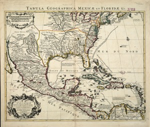
Carte du Mexique et des pays limitrophes situés au nord et à l'est : dressée d'après la grande carte de la Nouvelle Espagne...
2044.
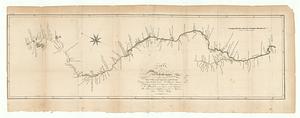
Carte du Mississippi dupuis sa source jusqu'a l'embouchure du Missouri
2045.
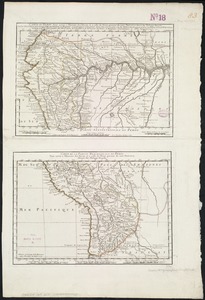
Carte du nouveau continent : selon sa plus grande longueur diametrale depuis la Riviere de la Plata jusqu'au de la du Lac des...
2046.
Carte du nouveau continent selon sa plus grande longueur diamètrale depuie la riv'. de la Plata jusqu'au delà du lac des...
2047.
Carte du pais d'Aunis ville & gounernement de la Rochelle
2048.
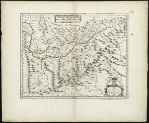
Carte du païs de Vallais, ou Wallis Der-Land
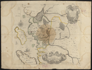
2049.
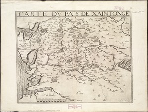
Carte du pais de Xaintonge
2050.
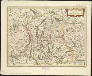
Carte du païs et duchè de Nivernois
2051.
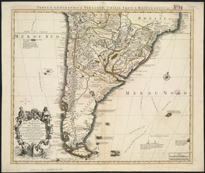
Carte du Paraguay, du Chili, du Detroit de Magellan &c
2052.
Carte du Perou, pour servir à l'histoire des Incas et à celle de l'etat present de cette province
2053.
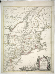
Carte du port et havre de Boston avec les côtes adjacentes, dans laquel on a tracée les camps et les retranchemens occupé,...
2054.
Carte du port et havre de Boston avec les côtes adjacentes, dans laquel on a tracée les camps et les retranchemens occupé,...
2055.
Carte du port et havre de Boston avec les côtes adjacentes, dans laquel on a tracée les camps et les retranchemens occupé,...
2056.
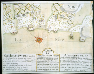
Carte du Pouldu avec ses environs et la côte de la mer : ou on y voit la disposition de nos batteries, et corps de garde, avec...
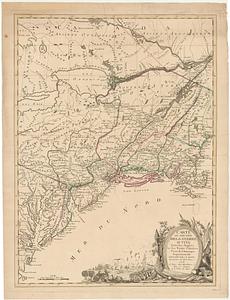
2057.
Carte du théatre de la guerre actuel entre les Anglais et les Treize Colonies Unies de l'Amerique Septentrionale
2058.
Carte du théatre de la guerre actuel entre les anglais et les Treize Colonies Unies de l'Amerique Septentrionale
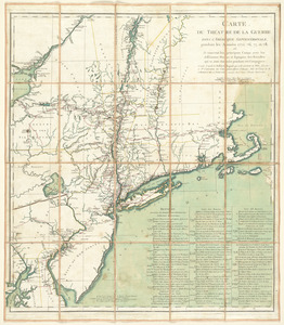
2059.
Carte du théatre de la guerre dans l'Amérique Septentrionale, pendant les années 1775, 76, 77, et 78 : où se trouvent les...
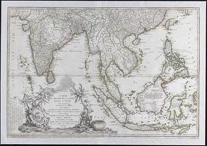
2060.
Carte du theatre de la guerre dans l'Inde ou se trouve une partie de la Chine; les isles Sumatra, Java, Borneo, Moluques et...
‹ Prev
Next ›
1
2
…
99
100
101
102
103
104
105
106
107
…
708
709