Toggle navigation
LMEC Home
Exhibitions
Georeferencing
Tools for Teachers
Collections
My Favorites
Sign Up / Log In
Search
Search the map portal
Map Collection
Map Collection
Map Sets
Search
Search
Search for
Search In
All Fields
Creator
Title
Subject
Place
Search All Digital Collections
Advanced Search
40 Results
My Search
Start Over
Date
1748
Remove constraint Date: <span class='single'>1748</span>
Filter your Search
Place
North and Central America
24
Canada
9
United States
9
North America
5
South America
5
New York
4
America
3
Europe
3
more
Place
»
Topic
Africa, West--Maps--Early works to 1800
2
America--Maps--Early works to 1800
2
Cape Breton Island (N.S.)--Maps, Manuscript--Early works to 1800
2
Fortification--Newfoundland and Labrador--St. John's--Maps, Manuscript--Early works to 1800
2
Fortification--Nova Scotia--Louisbourg--Maps, Manuscript--Early works to 1800
2
Fortification--Québec (Province)--Saint-Jean-sur-Richelieu--Maps, Manuscript--Early works to 1800
2
Harbors--Newfoundland and Labrador--St. John's--Maps, Manuscript--Early works to 1800
2
Louisbourg (N.S.)--Maps, Manuscript--Early works to 1800
2
more
Topic
»
Date
1748
[remove]
40
Date range begin
–
Date range end
Current results range from
1699
to
1800
1748
to
1748
40
Creator
Royal United Services Institute for Defence and Security Studies
7
Amherst, Jeffery Amherst, Baron, 1717-1797
5
George, III, King of Great Britain, 1738-1820
3
George, IV, King of Great Britain, 1762-1830
3
Anville, Jean Baptiste Bourguignon d', 1697-1782
2
Bellin, Jacques Nicolas, 1703-1772
2
Burghers, M.
2
Nolin, Jean Baptiste, 1686-1762
2
more
Creator
»
Format
Maps/Atlases
40
Manuscripts
5
Georeferenced
Yes
2
No
38
Collection
American Revolutionary War-Era Maps
23
Norman B. Leventhal Map & Education Center Collection
14
British Library Collection
12
William L. Clements Library Collection
7
MacLean Collection Map Library
4
Library of Congress Collection
1
Pechter Family Map Collection at Phillips Academy
1
Ralph Finos Map Collection at Phillips Academy
1
Available to use
No known restrictions
16
Creative Commons license
13
Search Constraints
Sort by relevance
relevance
title
date (asc)
date (desc)
Number of results to display per page
20 per page
10
per page
20
per page
50
per page
100
per page
View results as:
grid view
map view
Search Results
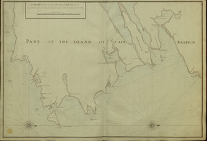
1.
[A manuscript map of Isle Royalle]
2.
[Acadie, Isle Saint Jean and part of Isle Royale with the Baye Francoise]
3.
Amérique Méridionale
4.
Amérique méridionale : publiée sous les auspices de Monseigneur le Duc d'Orleans prémier prince du Sang
5.
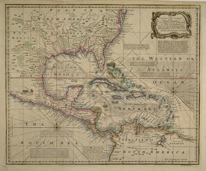
[Amerique septentrionale]
6.
Carte du diocèse d'Uzès
7.
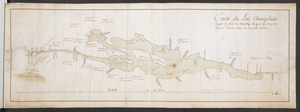
Carte du Lac Champlain depuis le Fort de Chambly Jusques au desus du Fort S.t Frederic, dans la Nouvelle France
8.
A CHART of the South East Part of l'Isle Royal, or Cape Bretton taken from the best Surveys, and the Observations of the most...
9.
Les Colonies des Européens en Amerique
10.
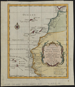
Costa occidentale dell' Africa dallo Stretto di Gibilterra fino al XI grado di latitudine settentrionale tratta dalla carta...
11.
Cuba, ciudad capittal de la ysla del mismo nombre y su famoso puerto sittuado en la costa del sur de gra. ysla, los 20 grados y...
12.
Le Diocese de Limoges : divisé en ses dix huict Archipretré et les Gouvernemens de la Marche et du Limosin dans les quels il...
13.
[Entrance to the Harbour of S.t Johns Newfoundland]
14.
The Gulf coast from the Mississippi Delta to the Bay of St. Joseph
15.
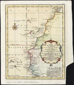
Karte von der westlichen kuste von Africa : von der strasse bey Gibraltar bis zu dem XI grade norderbreite ...wahrnehmungen...
16.
A map of lot no 1 in the Hardenbergh Patent
17.
A map of lot no 4 in the [Ha]rdenbergh Patent
18.
A map of part of the Isthmus of Darien : shewing the communication with Panama, from Portobello & Chagre both by land, and by...
19.
[Map showing Saint John's Harbour and a proposed fort]
20.
A new and accurate chart of the West Indies : with the adjacent coasts of North and South America
‹ Prev
Next ›
1
2
![[A manuscript map of Isle Royalle]](https://bpldcassets.blob.core.windows.net/derivatives/images/commonwealth:hx11z507d/image_thumbnail_300.jpg)
![[Acadie, Isle Saint Jean and part of Isle Royale with the Baye Francoise]](https://bpldcassets.blob.core.windows.net/derivatives/images/commonwealth:hx11z490f/image_thumbnail_300.jpg)

![[Amerique septentrionale]](https://bpldcassets.blob.core.windows.net/derivatives/images/commonwealth:8336h2955/image_thumbnail_300.jpg)


![[Entrance to the Harbour of S.t Johns Newfoundland]](https://bpldcassets.blob.core.windows.net/derivatives/images/commonwealth:6108vv35z/image_thumbnail_300.jpg)


![A map of lot no 4 in the [Ha]rdenbergh Patent](https://bpldcassets.blob.core.windows.net/derivatives/metadata/commonwealth-oai:zs262628v/image_thumbnail_300.jpg)

![[Map showing Saint John's Harbour and a proposed fort]](https://bpldcassets.blob.core.windows.net/derivatives/images/commonwealth:6108vw12v/image_thumbnail_300.jpg)