Toggle navigation
LMEC Home
Exhibitions
Georeferencing
Tools for Teachers
Collections
My Favorites
Sign Up / Log In
Search
Search the map portal
Map Collection
Map Collection
Map Sets
Search
Search
Search for
Search In
All Fields
Creator
Title
Subject
Place
Search All Digital Collections
Advanced Search
931 Results
My Search
Start Over
More Like
commonwealth-oai:ws85fg21w
Remove constraint More Like: commonwealth-oai:ws85fg21w
Filter your Search
Place
North and Central America
905
United States
643
Canada
208
New York
194
Quebec
111
Pennsylvania
61
New Jersey
54
Nova Scotia
48
more
Place
»
Topic
United States--History--Revolution, 1775-1783--Maps
305
United States--History--French and Indian War, 1754-1763--Maps
149
Saint Lawrence River--Maps
43
Newport (R.I.)--Maps
27
New York (State)--Maps
24
Hudson River (N.Y. and N.J.)--Maps
22
Québec (Québec)--Maps
21
Louisbourg (N.S.)--Maps
20
more
Topic
»
Date
Date range begin
–
Date range end
Current results range from
1700
to
1965
View distribution
Creator
Rocque, Mary Ann
29
Bellin, Jacques Nicolas, 1703-1772
25
Holland, Samuel, 1728-1801
25
Montrésor, John, 1736-1799
25
Jefferys, Thomas, -1771
24
Clinton, Henry, Sir, 1738?-1795
19
Robert Sayer and John Bennett (Firm)
15
Hills, John, active 1777-1819
13
more
Creator
»
Format
Maps/Atlases
915
Drawings/Illustrations
11
Documents
5
Prints
1
Georeferenced
Yes
1
No
930
Collection
American Revolutionary War-Era Maps
915
William L. Clements Library Collection
909
Norman B. Leventhal Map & Education Center Collection
16
MacLean Collection Map Library
3
American Antiquarian Society Collection
2
Applied Geographics, Inc. Records
1
Maritime Charts and Atlases
1
New York Public Library Collection
1
Available to use
No known restrictions
16
Creative Commons license
1
Search Constraints
Sort by relevance
relevance
title
date (asc)
date (desc)
Number of results to display per page
20 per page
10
per page
20
per page
50
per page
100
per page
View results as:
grid view
map view
Search Results
321.
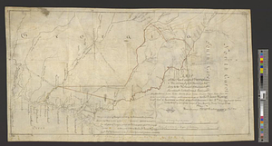
A map of the province of Massachusetts Bay, and colony of Rhode Island, with part of Connecticut, New Hampshire, and Vermont
322.
A map of the sea coast of Georgia & the inland parts thereof extending to the westward of that part of Savannah called Broad...
323.
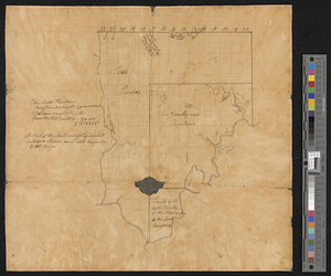
Map of the Second Nine Partners Tract in Dutchess County, protracted by a scale of one hundred chains to an inch
324.
A map of the United States
325.
Map of the United States and their territory
326.
A map of the United States east of the Mississippi River in which the land ceded by the Treaty of Paris is divided by parallels...
327.
A map of the United States east of the Mississippi River in which the land ceded by the Treaty of Paris is divided by parallels...
328.
A map of the United States of America as settled by the peace of 1783
329.
A map of the western parts of the colony of Virginia
330.
A map of two lots of land in Livingston, on the south side of the road leading from Johnstown to Ancram, containing 127 acres :...
331.
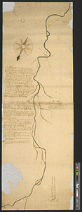
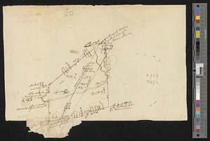
A map of West Florida and part of Et: Florida, Georgia part of So: Carolina i[n]cluding [torn] & Chactaw, Chickasaw & Creek...
332.
A map or draft of a certain tract and parcell of arable and low land of Collo. Henry Beekman being situate & lying within the...
333.
Mappa geographica Americae Septentrionalis ad emendatiora exemplaria adhuc edita jussu Acad. Reg. Scient. et eleg. litt. descripta
334.
Maumee Bay
335.
Middlesex Canal : copy'd from the survey of Mr. Thompson
336.
Monmouth County, New Jersey
337.
Moore's sketch of the navigation of the Highlands
338.
Moosehead Lake and the immediate area to the west : Québec July 25th, 1761
339.
Mr. Clarke's lot, Batavia
340.
Mr. Mathew's draft of the Scioto & Ohio Companies purchase
‹ Prev
Next ›
1
2
…
13
14
15
16
17
18
19
20
21
…
46
47

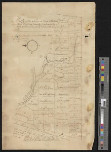


![A map of West Florida and part of Et: Florida, Georgia part of So: Carolina i[n]cluding [torn] & Chactaw, Chickasaw & Creek nations with [torn] [r]oad [torn] Pensacola through ye: Creek nation to Augusitus & Charlestown](https://bpldcassets.blob.core.windows.net/derivatives/metadata/commonwealth-oai:v98001375/image_thumbnail_300.jpg)