Toggle navigation
LMEC Home
Exhibitions
Georeferencing
Tools for Teachers
Collections
My Favorites
Sign Up / Log In
Search
Search the map portal
Map Collection
Map Collection
Map Sets
Search
Search
Search for
Search In
All Fields
Creator
Title
Subject
Place
Search All Digital Collections
Advanced Search
972 Results
My Search
Start Over
More Like
commonwealth-oai:wd379s939
Remove constraint More Like: commonwealth-oai:wd379s939
Filter your Search
Place
North and Central America
943
United States
682
New York
227
Canada
205
Quebec
111
Pennsylvania
61
New Jersey
59
Manhattan
49
more
Place
»
Topic
United States--History--Revolution, 1775-1783--Maps
330
United States--History--French and Indian War, 1754-1763--Maps
149
Manhattan (New York, N.Y.)--Maps
51
Saint Lawrence River--Maps
43
Newport (R.I.)--Maps
27
New York (N.Y.)--Maps
26
New York (State)--Maps
24
Hudson River (N.Y. and N.J.)--Maps
21
more
Topic
»
Date
Date range begin
–
Date range end
Current results range from
1700
to
1939
View distribution
Creator
Rocque, Mary Ann
29
Holland, Samuel, 1728-1801
25
Jefferys, Thomas, -1771
25
Montrésor, John, 1736-1799
25
Bellin, Jacques Nicolas, 1703-1772
24
Clinton, Henry, Sir, 1738?-1795
19
Robert Sayer and John Bennett (Firm)
16
Hills, John, active 1777-1819
13
more
Creator
»
Format
Maps/Atlases
956
Drawings/Illustrations
11
Documents
5
Manuscripts
5
Prints
1
Georeferenced
Yes
10
No
962
Collection
American Revolutionary War-Era Maps
931
William L. Clements Library Collection
909
Norman B. Leventhal Map & Education Center Collection
42
Urban Maps
26
American Antiquarian Society Collection
7
Boston and New England Maps
5
New-York Historical Society Collection
4
Newberry Library Collection
3
more
Collection
»
Available to use
No known restrictions
46
Creative Commons license
5
Search Constraints
Sort by relevance
relevance
title
date (asc)
date (desc)
Number of results to display per page
20 per page
10
per page
20
per page
50
per page
100
per page
View results as:
grid view
map view
Search Results
461.
A draft of the Ohio from an Indian account
462.
A draught of a route from Québec to Fort Halifax on the River Kennebec and back again to Québec by the rivers Chaudière and...
463.
Draught of a tract of land situate in Bucks County, in the Commonwealth of Pennsylvania divided in three parts, called...
464.
A draught of Massiac Lake, Maurepas, part of the river Amitt and the river Ibberville : copy from Lieut Ph: Pittman
465.
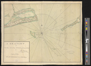
A draught of Ship & Catt islands and the opposite coast
466.
A draught of the barr off Mobile & Dauphine Island
467.
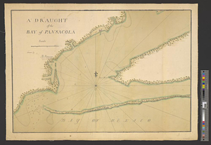
A draught of the bay of Pansacola
468.
A draught of the harbor & river of Piscataqua with the Island's of Shoal's
469.
A draught of the harbor & river of Piscataqua with the Island's of Shoal's
470.
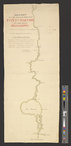
Draught of the passage from Lake Pontchartrin to the river Missisippi
471.
Draught of the river Delaware from Chester to Philadelphia
472.
A draught of the river Missisippi. From the Balise to Fort Cavendish : taken in the months of June, July, August, September,...
473.
Draught of the River Pittquioyack in the Bay of Fundy 1758
474.
Draught of the river St. Lawrence from Lake Ontario to Montreal
475.
A draught of the upper Creek nation, taken in May 1757
476.
The Dutch islands of St. Eustatia, Saba, and St. Martins; the French island of St. Bartholomew; the English islands of St....
477.
An east view of Fort [Franklin] on French Creek
478.
Eastern section of the United States
479.
Ensign Nathan Mc:Dowell's draft of the water of big Beaver &c to Lake Erie
480.
Etats Unis de l'Amerique
‹ Prev
Next ›
1
2
…
20
21
22
23
24
25
26
27
28
…
48
49


![An east view of Fort [Franklin] on French Creek](https://bpldcassets.blob.core.windows.net/derivatives/metadata/commonwealth-oai:dj5314216/image_thumbnail_300.jpg)