Toggle navigation
LMEC Home
Exhibitions
Georeferencing
Tools for Teachers
Collections
My Favorites
Sign Up / Log In
Search
Search the map portal
Map Collection
Map Collection
Map Sets
Search
Search
Search for
Search In
All Fields
Creator
Title
Subject
Place
Search All Digital Collections
Advanced Search
953 Results
My Search
Start Over
More Like
commonwealth-oai:st74hp42z
Remove constraint More Like: commonwealth-oai:st74hp42z
Filter your Search
Place
North and Central America
913
United States
637
Canada
221
New York
193
Quebec
114
Saint Lawrence River
66
Pennsylvania
60
New Jersey
54
more
Place
»
Topic
United States--History--Revolution, 1775-1783--Maps
305
United States--History--French and Indian War, 1754-1763--Maps
162
Saint Lawrence River--Maps
67
Newport (R.I.)--Maps
27
Québec (Québec)--Maps
27
New York (State)--Maps
25
Hudson River (N.Y. and N.J.)--Maps
21
Louisbourg (N.S.)--Maps
20
more
Topic
»
Date
Date range begin
–
Date range end
Current results range from
1700
to
1900
View distribution
Creator
Jefferys, Thomas, -1771
30
Holland, Samuel, 1728-1801
29
Montrésor, John, 1736-1799
29
Rocque, Mary Ann
29
Bellin, Jacques Nicolas, 1703-1772
28
Clinton, Henry, Sir, 1738?-1795
19
Robert Sayer and John Bennett (Firm)
16
Orme, Robert, -1781
14
more
Creator
»
Format
Maps/Atlases
937
Drawings/Illustrations
11
Documents
5
Manuscripts
1
Prints
1
Georeferenced
No
953
Collection
American Revolutionary War-Era Maps
948
William L. Clements Library Collection
909
Library and Archives Canada Collection
19
Norman B. Leventhal Map & Education Center Collection
9
American Antiquarian Society Collection
5
Richard H. Brown Revolutionary War Map Collection at Mount Vernon
4
MacLean Collection Map Library
3
New York Public Library Collection
3
more
Collection
»
Available to use
No known restrictions
10
Creative Commons license
7
Search Constraints
Sort by relevance
relevance
title
date (asc)
date (desc)
Number of results to display per page
20 per page
10
per page
20
per page
50
per page
100
per page
View results as:
grid view
map view
Search Results
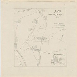
701.
Plan of the battle fought near Camden August 16th 1780
702.
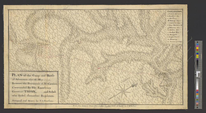
Plan of the Battle of Gum Swamp alias Sutton Wood, on the 16th August 1780 between the royal army, 1600, commanded by Lieut:...
703.
Plan of the bay of Saldanha on the S.W. coast of Africa shewing the opperations [sic] of the squadron of Commodore Johnstone,...
704.
Plan of the British attack on Mud Island, Pennsylvania
705.
Plan of the camp and battle of Alamance the 16 May 1771 between the provincials of Nth: Carolina, commanded by his excellency...
706.
Plan of the city & harbour of Havanna, capital of Cuba
707.
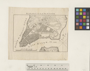
Plan of the city of New York
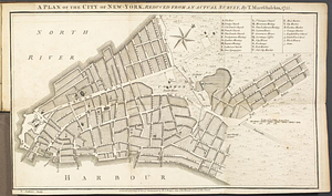
708.
A plan of the city of New-York, reduced from an actual survey
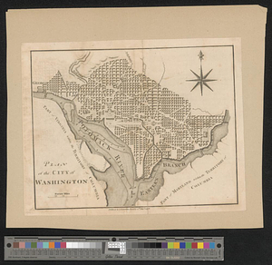
709.
Plan of the city of Washington
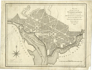
710.
Plan of the city of Washington; now building for the metropolis of America, and established as the permanent residence of...
711.
A plan of the coast of Newfoundland from Cape Bonavista to Cape Chapeau Rouge wherein seven-eights of the fishery of the island...
712.
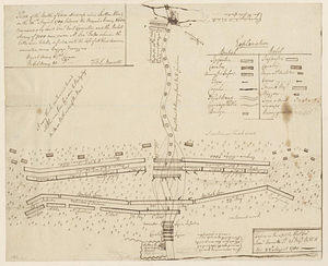
Plan of the decent [sic] and action of the 29th Decr. 1778, near the town of Savannah; by his majestys forces, under the...
713.
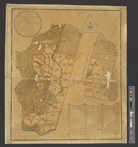
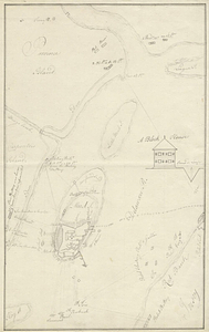
A plan of the entervale [sic] and hundred acre lotts in the township of Piermont
714.
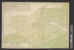
Plan of the entrance of the Harbour of Pensacola shewing the situation of the new battery's laid out and begun building in...
715.
A plan of the environs of Brooklyn showing the position of the rebel lines and defences on the 27th of August 1776
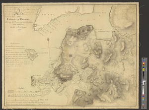
716.
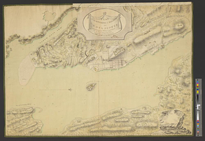
Plan of the environs of Halifax in Nova Scotia with the temporary works constructed for the protection of the town, and His...
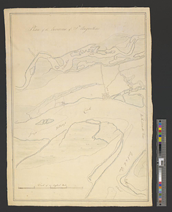
717.
Plan of the environs of St. Augustine
718.
Plan of the estates of Admiral Sr. Jas. Douglas bart. called Douglas & Ravenscroft, and the estate of Robert Harvey esqr....
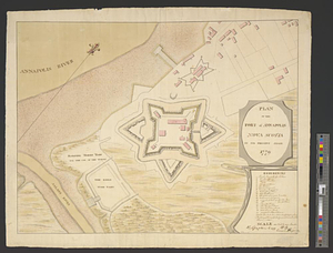
719.
Plan of the fort of Annapolis Nova Scotia in its present state 1779
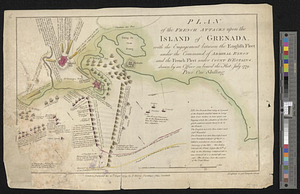
720.
Plan of the French attacks upon the island of Grenada, with the engagement between the English fleet under the command of...
‹ Prev
Next ›
1
2
…
32
33
34
35
36
37
38
39
40
…
47
48
![Plan of the bay of Saldanha on the S.W. coast of Africa shewing the opperations [sic] of the squadron of Commodore Johnstone, in the attack upon the five Dutch East India ships on the morning of July 21st: AD: 1781](https://bpldcassets.blob.core.windows.net/derivatives/metadata/commonwealth-oai:7d27dp94q/image_thumbnail_300.jpg)

![A plan of the coast of Newfoundland from Cape Bonavista to Cape Chapeau Rouge wherein seven-eights of the fishery of the island is caried [sic] on](https://bpldcassets.blob.core.windows.net/derivatives/metadata/commonwealth-oai:cz30tq534/image_thumbnail_300.jpg)
![Plan of the decent [sic] and action of the 29th Decr. 1778, near the town of Savannah; by his majestys forces, under the command of Lt. Colol. Campbell of the 71st Regt. foot](https://bpldcassets.blob.core.windows.net/derivatives/metadata/commonwealth-oai:qj72t576b/image_thumbnail_300.jpg)
![A plan of the entervale [sic] and hundred acre lotts in the township of Piermont](https://bpldcassets.blob.core.windows.net/derivatives/metadata/commonwealth-oai:02874t092/image_thumbnail_300.jpg)