Toggle navigation
LMEC Home
Exhibitions
Georeferencing
Tools for Teachers
Collections
My Favorites
Sign Up / Log In
Search
Search the map portal
Map Collection
Map Collection
Map Sets
Search
Search
Search for
Search In
All Fields
Creator
Title
Subject
Place
Search All Digital Collections
Advanced Search
1018 Results
My Search
Start Over
More Like
commonwealth-oai:m039q439t
Remove constraint More Like: commonwealth-oai:m039q439t
Filter your Search
Place
North and Central America
992
United States
728
Canada
205
New York
199
Quebec
111
Pennsylvania
90
New Jersey
62
Nova Scotia
48
more
Place
»
Topic
United States--History--Revolution, 1775-1783--Maps
305
United States--History--French and Indian War, 1754-1763--Maps
149
Pennsylvania--Maps
50
Saint Lawrence River--Maps
43
New York (State)--Maps
32
Newport (R.I.)--Maps
27
Ohio--Maps
27
New Jersey--Maps
22
more
Topic
»
Date
Date range begin
–
Date range end
Current results range from
1700
to
1934
View distribution
Creator
Rocque, Mary Ann
29
Bellin, Jacques Nicolas, 1703-1772
25
Holland, Samuel, 1728-1801
25
Montrésor, John, 1736-1799
25
Jefferys, Thomas, -1771
24
Clinton, Henry, Sir, 1738?-1795
19
United States. Post Office Dept
18
Robert Sayer and John Bennett (Firm)
15
more
Creator
»
Format
Maps/Atlases
1,002
Drawings/Illustrations
11
Documents
5
Manuscripts
1
Prints
1
Georeferenced
Yes
39
No
979
Collection
American Revolutionary War-Era Maps
919
William L. Clements Library Collection
909
Norman B. Leventhal Map & Education Center Collection
103
American Antiquarian Society Collection
4
MacLean Collection Map Library
1
Massachusetts Historical Society Map Collection
1
Urban Maps
1
Available to use
No known restrictions
103
Creative Commons license
1
Search Constraints
Sort by relevance
relevance
title
date (asc)
date (desc)
Number of results to display per page
20 per page
10
per page
20
per page
50
per page
100
per page
View results as:
grid view
map view
Search Results
1.
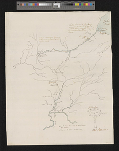
A draft of the Ohio from an Indian account
2.
Map of the states of Ohio, Indiana and Illinois with the settled parts of Michigan & Wisconsin
3.
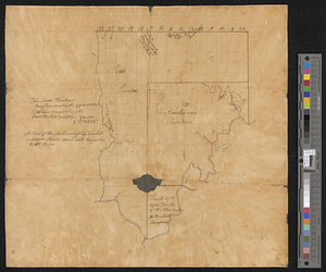
Manuscript maps of U.S. states
4.
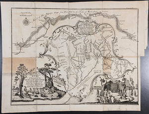
Carte composée des differens ouvrages de messieurs les ingenieurs qui ont eté à Louisiane, avec les renvois alphabetiques de...
5.
A draught of the river Missisippi. From the Balise to Fort Cavendish : taken in the months of June, July, August, September,...
6.
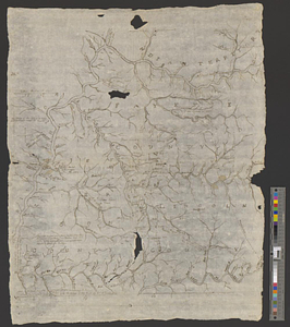
Plan of the Indian countrys through which the troops marchd in 1764 under the command of Col. Henry Bouquet
7.
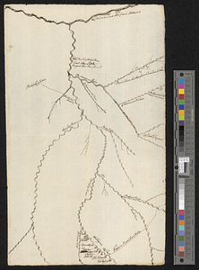
A sketch of the several Indian roads leading from Fort Pitt to Sioto, Lake Erie &c. : takn. from a draft (made on a tour thro'...
8.
A map of part of the N:W: Territory of the United States : compiled from actual surveys, and the best information
9.
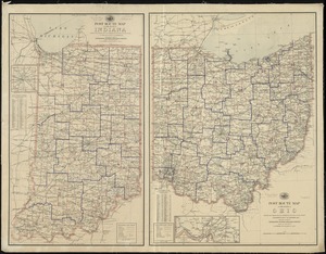
Post route map of the State of Ohio showing post offices with the intermediate distances and mail routes in operation on the...
10.
Post route map of the states of Ohio and Indiana with adjacent parts of Pennsylvania, Michigan, Illinois, Kentucky and West...
11.
Colton's map of the oil district of West Virginia and Ohio
12.
Map of Virginia, West Virginia and Ohio : showing Norfolk and Western Railway : main line branches and connections
13.
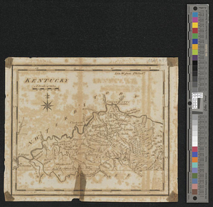
Kentucky
14.
Map of the area between Fort Loudon, Tennessee, and Kaskaskia, Illinois
15.
This map of Kentucke, drawn from actual observations ...
16.
Action between Genl. St Clairs army & that of the American Indians Novr. 4th 1791 : collected from his public letter
17.
Campaign of Major General Anthony Wayne, 1793-94
18.
Mr. Mathew's draft of the Scioto & Ohio Companies purchase
19.
Plan of St. Clairs battle ground
20.
A topographical plan of that part of the Indian-country through which the army under the command of Colonel Bouquet marched in...
‹ Prev
Next ›
1
2
3
4
5
…
50
51