Toggle navigation
LMEC Home
Exhibitions
Georeferencing
Tools for Teachers
Collections
My Favorites
Sign Up / Log In
Search
Search the map portal
Map Collection
Map Collection
Map Sets
Search
Search
Search for
Search In
All Fields
Creator
Title
Subject
Place
Search All Digital Collections
Advanced Search
928 Results
My Search
Start Over
More Like
commonwealth-oai:jm218p051
Remove constraint More Like: commonwealth-oai:jm218p051
Filter your Search
Place
North and Central America
898
United States
638
Canada
209
New York
194
Quebec
112
Pennsylvania
60
New Jersey
54
Nova Scotia
48
more
Place
»
Topic
United States--History--Revolution, 1775-1783--Maps
305
United States--History--French and Indian War, 1754-1763--Maps
162
Saint Lawrence River--Maps
43
Newport (R.I.)--Maps
27
New York (State)--Maps
25
Hudson River (N.Y. and N.J.)--Maps
21
Québec (Québec)--Maps
21
Louisbourg (N.S.)--Maps
20
more
Topic
»
Date
Date range begin
–
Date range end
Current results range from
1700
to
1900
View distribution
Creator
Rocque, Mary Ann
29
Jefferys, Thomas, -1771
28
Holland, Samuel, 1728-1801
25
Montrésor, John, 1736-1799
25
Bellin, Jacques Nicolas, 1703-1772
24
Clinton, Henry, Sir, 1738?-1795
19
Robert Sayer and John Bennett (Firm)
15
Orme, Robert, -1781
14
more
Creator
»
Format
Maps/Atlases
912
Drawings/Illustrations
11
Documents
5
Prints
1
Georeferenced
No
928
Collection
American Revolutionary War-Era Maps
923
William L. Clements Library Collection
909
Norman B. Leventhal Map & Education Center Collection
9
Richard H. Brown Revolutionary War Map Collection at Mount Vernon
4
Maps from AAS
3
Library and Archives Canada Collection
1
MacLean Collection Map Library
1
New-York Historical Society Collection
1
Available to use
No known restrictions
10
Creative Commons license
4
Search Constraints
Sort by relevance
relevance
title
date (asc)
date (desc)
Number of results to display per page
20 per page
10
per page
20
per page
50
per page
100
per page
View results as:
grid view
map view
Search Results
301.
A draught of the harbor & river of Piscataqua with the Island's of Shoal's
302.
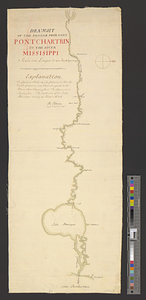
Draught of the passage from Lake Pontchartrin to the river Missisippi
303.
Draught of the river Delaware from Chester to Philadelphia
304.
A draught of the river Missisippi. From the Balise to Fort Cavendish : taken in the months of June, July, August, September,...
305.
A draught of the towns of Boston & Charles Town & the circumjacent country, shewing the works thrown up by the kings troops, &...
306.
A draught of the upper Creek nation, taken in May 1757
307.
Draught of the watering place & redouts constructed to defend it, 15th: July 1776
308.
The Dutch islands of St. Eustatia, Saba, and St. Martins; the French island of St. Bartholomew; the English islands of St....
309.
An east view of Fort [Franklin] on French Creek
310.
Eastern section of the United States
311.
Ensign Nathan Mc:Dowell's draft of the water of big Beaver &c to Lake Erie
312.
Etats Unis de l'Amerique
313.
An exact map of Nova Scotia, Newfoundland, gulf and river St. Laurence, and coast of Labrador from the latest observations 1777
314.
An exact map of the five Great Lakes, with part of Pensilvania, New York, Canada and Hudsons Bay territories from the best surveys
315.
Exact plan of General Gage's lines on Boston Neck in America
316.
Explanation of the references
317.
Falmouth, Maine
318.
Flatbush
319.
La Floride divisée en Floride et Caroline
320.
Flynt Jenkins sold to Taylor Foster &c plans 1778
‹ Prev
Next ›
1
2
…
12
13
14
15
16
17
18
19
20
…
46
47


![An east view of Fort [Franklin] on French Creek](https://bpldcassets.blob.core.windows.net/derivatives/metadata/commonwealth-oai:dj5314216/image_thumbnail_300.jpg)