Toggle navigation
LMEC Home
Exhibitions
Georeferencing
Tools for Teachers
Collections
My Favorites
Sign Up / Log In
Search
Search the map portal
Map Collection
Map Collection
Map Sets
Search
Search
Search for
Search In
All Fields
Creator
Title
Subject
Place
Search All Digital Collections
Advanced Search
971 Results
My Search
Start Over
More Like
commonwealth-oai:cz30tq54d
Remove constraint More Like: commonwealth-oai:cz30tq54d
Filter your Search
Place
North and Central America
943
United States
682
New York
227
Canada
205
Quebec
111
Pennsylvania
61
New Jersey
60
Manhattan
49
more
Place
»
Topic
United States--History--Revolution, 1775-1783--Maps
330
United States--History--French and Indian War, 1754-1763--Maps
149
Manhattan (New York, N.Y.)--Maps
51
Saint Lawrence River--Maps
43
Newport (R.I.)--Maps
27
New York (N.Y.)--Maps
26
New York (State)--Maps
24
Hudson River (N.Y. and N.J.)--Maps
21
more
Topic
»
Date
Date range begin
–
Date range end
Current results range from
1700
to
1939
View distribution
Creator
Rocque, Mary Ann
29
Holland, Samuel, 1728-1801
25
Jefferys, Thomas, -1771
25
Montrésor, John, 1736-1799
25
Bellin, Jacques Nicolas, 1703-1772
24
Clinton, Henry, Sir, 1738?-1795
19
Robert Sayer and John Bennett (Firm)
16
Hills, John, active 1777-1819
13
more
Creator
»
Format
Maps/Atlases
955
Drawings/Illustrations
11
Documents
5
Manuscripts
4
Prints
1
Georeferenced
Yes
10
No
961
Collection
American Revolutionary War-Era Maps
930
William L. Clements Library Collection
909
Norman B. Leventhal Map & Education Center Collection
42
Urban Maps
26
American Antiquarian Society Collection
7
Boston and New England Maps
5
New-York Historical Society Collection
3
Newberry Library Collection
3
more
Collection
»
Available to use
No known restrictions
45
Creative Commons license
5
Search Constraints
Sort by relevance
relevance
title
date (asc)
date (desc)
Number of results to display per page
20 per page
10
per page
20
per page
50
per page
100
per page
View results as:
grid view
map view
Search Results
741.
Plan of Fort [Brewerton] at the west end of Onnide Lake
742.
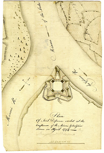
Plan of Fort Defiance, erected at the confluence of the Miami & Au Glaise rivers in August, 1794
743.
Plan of Fort Edward situated lat. 43 lon. 72 30'
744.
Plan of Fort [Franklin] on French Creek : built by a detachment of the 1st U.S. Regt., 1787
745.
Plan of Fort Frederick at Albany
746.
A plan of Fort Frederick, situated at the entrance of St. John's River : lat 47 long. 66 30'
747.
Plan of Fort Frontenac
748.
Plan of Fort le Quesne, built by the French at the fort of the Ohio and monongahela in 1754
749.
Plan of Fort Lernoult and the town of Detroit
750.
A plan of Fort Ligonier done by Theodosius McDonald for George Morton : February 8th annoque domini 1760
751.
Plan of Fort Massachusetts - Rocklanding - 1792
752.
Plan of Fort Massachusetts in Georgia and the country adjacent - 1792
753.
Plan of Fort Niagara, with its environ
754.
A plan of Fort Ontario
755.
Plan of Fort Ontario built at Oswego in 1759
756.
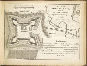
Plan of Fort Stanwix, built at Oneida Station, by provincial troops, in 1758
757.
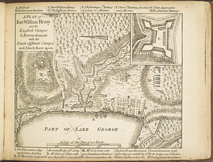
A plan of Fort William Henry and the English camps & retrenchments with the French different camps and attack there upon
758.
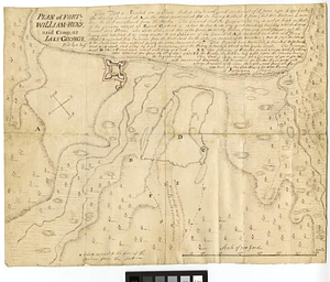
Plan of Fort-William-Henry and camp, at Lake George
759.
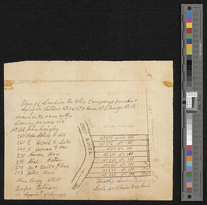
Plan of lands in the Ohio Companys purchase lying in sections no 1 & no 7 town no 2 range no 12
760.
Plan of Long Island in New York governement [sic] Nort [sic] America
‹ Prev
Next ›
1
2
…
34
35
36
37
38
39
40
41
42
…
48
49
![Plan of Fort [Brewerton] at the west end of Onnide Lake](https://bpldcassets.blob.core.windows.net/derivatives/metadata/commonwealth-oai:639615613/image_thumbnail_300.jpg)

![Plan of Fort [Franklin] on French Creek](https://bpldcassets.blob.core.windows.net/derivatives/metadata/commonwealth-oai:5x21zf368/image_thumbnail_300.jpg)


![Plan of Long Island in New York governement [sic] Nort [sic] America](https://bpldcassets.blob.core.windows.net/derivatives/metadata/commonwealth-oai:z890ws44r/image_thumbnail_300.jpg)