Toggle navigation
LMEC Home
Exhibitions
Georeferencing
Tools for Teachers
Collections
My Favorites
Sign Up / Log In
Search
Search the map portal
Map Collection
Map Collection
Map Sets
Search
Search
Search for
Search In
All Fields
Creator
Title
Subject
Place
Search All Digital Collections
Advanced Search
946 Results
My Search
Start Over
More Like
commonwealth-oai:c534kn48m
Remove constraint More Like: commonwealth-oai:c534kn48m
Filter your Search
Place
North and Central America
910
United States
629
Canada
220
New York
194
Quebec
119
Saint Lawrence River
66
Pennsylvania
60
New Jersey
54
more
Place
»
Topic
United States--History--Revolution, 1775-1783--Maps
305
United States--History--French and Indian War, 1754-1763--Maps
149
Saint Lawrence River--Maps
67
Newport (R.I.)--Maps
27
New York (State)--Maps
24
Québec (Québec)--Maps
24
Hudson River (N.Y. and N.J.)--Maps
21
Louisbourg (N.S.)--Maps
20
more
Topic
»
Date
Date range begin
–
Date range end
Current results range from
1700
to
1923
View distribution
Creator
Montrésor, John, 1736-1799
29
Rocque, Mary Ann
29
Bellin, Jacques Nicolas, 1703-1772
28
Holland, Samuel, 1728-1801
28
Jefferys, Thomas, -1771
26
Clinton, Henry, Sir, 1738?-1795
19
Robert Sayer and John Bennett (Firm)
17
Cook, James, 1728-1779
13
more
Creator
»
Format
Maps/Atlases
930
Drawings/Illustrations
11
Documents
5
Manuscripts
1
Prints
1
Georeferenced
No
946
Collection
American Revolutionary War-Era Maps
934
William L. Clements Library Collection
909
Library and Archives Canada Collection
17
Norman B. Leventhal Map & Education Center Collection
12
MacLean Collection Map Library
3
New York Public Library Collection
3
American Antiquarian Society Collection
2
Boston and New England Maps
1
Available to use
No known restrictions
12
Creative Commons license
3
Search Constraints
Sort by relevance
relevance
title
date (asc)
date (desc)
Number of results to display per page
20 per page
10
per page
20
per page
50
per page
100
per page
View results as:
grid view
map view
Search Results
1.
French draught of Lake Champlain & Lake George with remarks of an English prisoner who return'd from Quebec to Fort Edward by...
2.
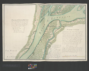
Parish of La Norray & Dautray. Parish of Sorrel
3.
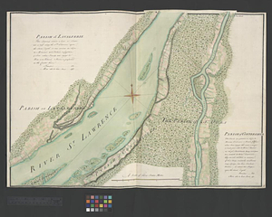
Parish of Lavalterie. Parish of Contrecoeur
4.
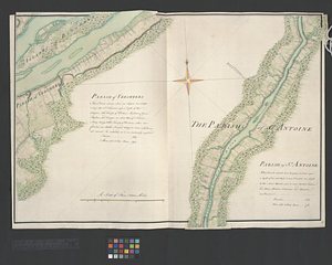
Parish of Vercheres. Parish of St. Antoine
5.
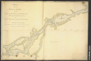
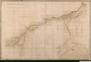
A plan of part of the province of Quebec from the Lake de Deux Montagne to River Batiscant made agreeable to the orders &...
6.
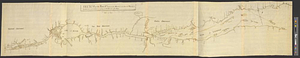
Plan of that part of Canada and the River St. Lawrence which lies between Point du Lac and Repentigny on the north shore &...
7.
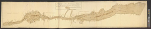
A plan of the settled part of Canada reduced from the large survey made in the years 1760 & 1761 by order of General Murray...
8.
Continuation of the Grande Riviere with the village of Fariole lying near Cape Torment on the north shore
9.
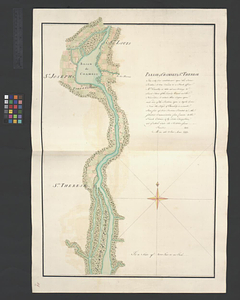
Sketch of the river St. Lawrence from Montreal to the island St. Barnaby on the south side and the islands of Jeremy on the...
10.
Sketch of the river St: Lawrence from Montreal to the island St: Barnaby on the south side, and the islands of Jeremy on the...
11.
Sketch of the seven dangerous rappids with their true channel : also the appearance the river makes at those places between...
12.
Plan of Canada or the province of Quebec from the uppermost settlements to the island of Coudre as surveyed by order of his...
13.
Parish of Chambly & Ste. Therese
14.
Parish of St. Charles
15.
Part of the Richelieu River showing Fort de St. Ieant
16.
Part of the Richelieu River showing Isle aux Noix
17.
The attack and defeat of the American fleet under Benedict Arnold, by the kings fleet commanded by Captn. Thos. Pringle, upon...
18.
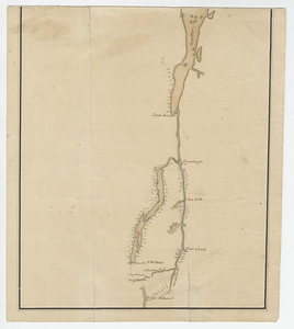
Crown Point to Fort Edward, New York
19.
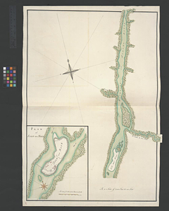
Fort Edward to Ticonderoga
20.
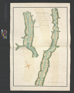
Lake Champlain
‹ Prev
Next ›
1
2
3
4
5
…
47
48