Toggle navigation
LMEC Home
Exhibitions
Georeferencing
Tools for Teachers
Collections
My Favorites
Sign Up / Log In
Search
Search the map portal
Map Collection
Map Collection
Map Sets
Search
Search
Search for
Search In
All Fields
Creator
Title
Subject
Place
Search All Digital Collections
Advanced Search
1000 Results
My Search
Start Over
More Like
commonwealth-oai:b2777s68s
Remove constraint More Like: commonwealth-oai:b2777s68s
Filter your Search
Place
North and Central America
972
United States
710
Canada
206
New York
201
Quebec
112
Pennsylvania
91
New Jersey
80
Massachusetts
50
more
Place
»
Topic
United States--History--Revolution, 1775-1783--Maps
330
United States--History--French and Indian War, 1754-1763--Maps
149
Pennsylvania--Maps
50
Saint Lawrence River--Maps
43
New Jersey--Maps
40
New York (State)--Maps
34
Newport (R.I.)--Maps
27
Maryland--Maps
25
more
Topic
»
Date
Date range begin
–
Date range end
Current results range from
1700
to
1921
View distribution
Creator
Rocque, Mary Ann
29
Holland, Samuel, 1728-1801
26
Bellin, Jacques Nicolas, 1703-1772
25
Jefferys, Thomas, -1771
25
Montrésor, John, 1736-1799
25
Clinton, Henry, Sir, 1738?-1795
19
Robert Sayer and John Bennett (Firm)
16
Kitchin, Thomas, 1719-1784
13
more
Creator
»
Format
Maps/Atlases
984
Drawings/Illustrations
11
Documents
5
Manuscripts
5
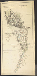
Prints
1
Georeferenced
Yes
27
No
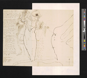
973
Collection
American Revolutionary War-Era Maps
945
William L. Clements Library Collection
909
Norman B. Leventhal Map & Education Center Collection
60
Maps from AAS
15
MacLean Collection Map Library
6
Boston and New England Maps
5
Urban Maps
5
Newberry Library Collection
3
more
Collection
»
Available to use
No known restrictions
62
Creative Commons license
5
Search Constraints
Sort by relevance
relevance
title
date (asc)
date (desc)
Number of results to display per page
20 per page
10
per page
20
per page
50
per page
100
per page
View results as:
grid view
map view
Search Results
101.
Hudson River from West Point to Dobbs Ferry
102.
Hudson's River from Stony Pt. to Fort Montgomery
103.
Isle de Newyork : reconnaissance des ouvrages du nord de lisle de Newyork faite en presence des Généraux, Wasington et...
104.
Kings Bridge
105.
Lent's Creek and Baillies Creek
106.
Lines of Charleston
107.
Long Island
108.
Map of New York I. with the adjacent rocks and other remarkable parts of Hell-Gate
109.
A map of the country adjacent to Kingsbridge, surveyed by order of his excellency General Sir Henry Clinton K.B., commander in...
110.
A map of the environs of Boston
111.
A map of the environs of Brooklyn : surveyed by order of his excellency General Sir Henry Clinton K.B., commander in chief of...
112.
A map of the pass at Jamaica, Long Island : surveyed by order of his excellency General Sir Henry Clinton K:B: commander in...
113.
Map of the powers at war with Great Britain, 1783
114.
Monmouth County, New Jersey
115.
Moore's sketch of the navigation of the Highlands
116.
Narragansett Bay and Rhode Island
117.
A new and correct plan of the town of Boston
118.
The New York campaign of 1776
119.
The New York campaign of 1776
120.
Newark Bay and its immediate vicinity
‹ Prev
Next ›
1
2
3
4
5
6
7
8
9
10
…
49
50