Toggle navigation
LMEC Home
Exhibitions
Georeferencing
Tools for Teachers
Collections
My Favorites
Sign Up / Log In
Search
Search the map portal
Map Collection
Map Collection
Map Sets
Search
Search
Search for
Search In
All Fields
Creator
Title
Subject
Place
Search All Digital Collections
Advanced Search
931 Results
My Search
Start Over
More Like
commonwealth-oai:6d573t27d
Remove constraint More Like: commonwealth-oai:6d573t27d
Filter your Search
Place
North and Central America
904
United States
630
Canada
225
New York
192
Quebec
111
Pennsylvania
60
Nova Scotia
56
New Jersey
54
more
Place
»
Topic
United States--History--Revolution, 1775-1783--Maps
305
United States--History--French and Indian War, 1754-1763--Maps
149
Saint Lawrence River--Maps
43
Newport (R.I.)--Maps
27
New York (State)--Maps
24
Hudson River (N.Y. and N.J.)--Maps
21
Québec (Québec)--Maps
21
Louisbourg (N.S.)--Maps
20
more
Topic
»
Date
Date range begin
–
Date range end
Current results range from
1700
to
1999
View distribution
Creator
Rocque, Mary Ann
29
Bellin, Jacques Nicolas, 1703-1772
25
Holland, Samuel, 1728-1801
25
Montrésor, John, 1736-1799
25
Jefferys, Thomas, -1771
24
Clinton, Henry, Sir, 1738?-1795
19
Robert Sayer and John Bennett (Firm)
16
Hills, John, active 1777-1819
13
more
Creator
»
Format
Maps/Atlases
915
Drawings/Illustrations
11
Documents
5
Prints
1
Georeferenced
No
931
Collection
American Revolutionary War-Era Maps
913
William L. Clements Library Collection
909
Norman B. Leventhal Map & Education Center Collection
18
Maritime Charts and Atlases
4
Boston and New England Maps
2
American Antiquarian Society Collection
1
Applied Geographics, Inc. Records
1
David Judkins Weaver Papers
1
more
Collection
»
Available to use
No known restrictions
18
Creative Commons license
1
Search Constraints
Sort by relevance
relevance
title
date (asc)
date (desc)
Number of results to display per page
20 per page
10
per page
20
per page
50
per page
100
per page
View results as:
grid view
map view
Search Results
1.
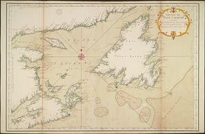
An exact map of Nova Scotia, Newfoundland, gulf and river St. Laurence, and coast of Labrador from the latest observations 1777
2.
The River & Gulf of St. Lawrence, Newfoundland, Nova Scotia, and the banks adjacent : from the British Admiralty, French Marine...
3.
Coal fields of Nova Scotia and New Brunswick
4.
A new chart of ye coast of New Found Land, New Scotland and New England &c.
5.
North America : British provinces of New Brunswick, Nova Scotia, & part of Canada : compiled from recent surveys and adjusted...
6.
Carte du Golphe de St. Laurent et pays voisins pour servir à l'histoire générale des voyages
7.
The coast from St. Johns, New Brunswick, to Goldsborough Bay, Maine
8.
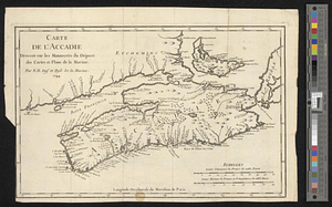
Carte de l'Accadie : dressée sur les manuscrits de Dépot des Cartes et Plans de la Marine
9.
A chart of the peninsula of Nova Scotia
10.
Map of the coast of Cape Breton from Fort William to Louisbourg
11.
A rude sketch of a part of the road between the township of Horton and Granville on the river of Annapolis, relative to a...
12.
Golphe de Saint Laurent, contenant l'Isle de Terreneuve, Detroit de Belle-Isle, entrée du Fleuve St. Laurent, Isle Royale, et...
13.
Limits under fishery treaties, 1818 and 1888
14.
New Brunswick, Nova Scotia, Newfoundland, and Prince Edward Id.
15.
North America, Dominion of Canada, Gulf of Saint Lawrence, south coast of Quebec from Washtawooka Bay to Cape Mackinnon :...
16.
North America, Gulf of Saint Lawrence : compiled from the latest information
17.
Explorer's map & directory of the New England Coast : New London, Connecticut, to Passamaquoddy Bay, Canada : a comprehensive...
18.
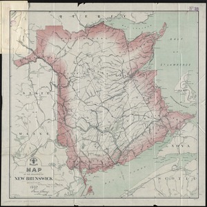
Map of the province of New Brunswick
19.
Map of the state of Maine with the province of New Brunswick
20.
A map of Upper and Lower Canada : with part of the United States adjoining, comprising the present seat of war
‹ Prev
Next ›
1
2
3
4
5
…
46
47