Toggle navigation
LMEC Home
Exhibitions
Georeferencing
Tools for Teachers
Collections
My Favorites
Sign Up / Log In
Search
Search the map portal
Map Collection
Map Collection
Map Sets
Search
Search
Search for
Search In
All Fields
Creator
Title
Subject
Place
Search All Digital Collections
Advanced Search
957 Results
My Search
Start Over
More Like
commonwealth-oai:63961558s
Remove constraint More Like: commonwealth-oai:63961558s
Filter your Search
Place
North and Central America
917
United States
640
Canada
224
New York
193
Quebec
120
Saint Lawrence River
66
Pennsylvania
60
New Jersey
54
more
Place
»
Topic
United States--History--Revolution, 1775-1783--Maps
305
United States--History--French and Indian War, 1754-1763--Maps
162
Saint Lawrence River--Maps
67
Newport (R.I.)--Maps
27
New York (State)--Maps
25
Québec (Québec)--Maps
24
Hudson River (N.Y. and N.J.)--Maps
21
Louisbourg (N.S.)--Maps
20
more
Topic
»
Date
Date range begin
–
Date range end
Current results range from
1700
to
1923
View distribution
Creator
Jefferys, Thomas, -1771
30
Montrésor, John, 1736-1799
29
Rocque, Mary Ann
29
Bellin, Jacques Nicolas, 1703-1772
28
Holland, Samuel, 1728-1801
28
Clinton, Henry, Sir, 1738?-1795
19
Robert Sayer and John Bennett (Firm)
17
Orme, Robert, -1781
14
more
Creator
»
Format
Maps/Atlases
941
Drawings/Illustrations
11
Documents
5
Manuscripts
1
Prints
1
Georeferenced
No
957
Collection
American Revolutionary War-Era Maps
947
William L. Clements Library Collection
909
Library and Archives Canada Collection
17
Norman B. Leventhal Map & Education Center Collection
14
American Antiquarian Society Collection
5
MacLean Collection Map Library
4
Richard H. Brown Revolutionary War Map Collection at Mount Vernon
4
New York Public Library Collection
3
more
Collection
»
Available to use
No known restrictions
15
Creative Commons license
7
Search Constraints
Sort by relevance
relevance
title
date (asc)
date (desc)
Number of results to display per page
20 per page
10
per page
20
per page
50
per page
100
per page
View results as:
grid view
map view
Search Results
541.
Part of modern Rockingham County
542.
Part of modern Rockingham County (N.H.) and Essex County (Mass.)
543.
Part of modern Westchester County
544.
Part of modern Westchester County
545.
Part of modern Westchester County
546.
Part of modern Westmoreland County
547.
Part of Monmouth County, New Jersey
548.
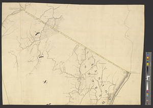
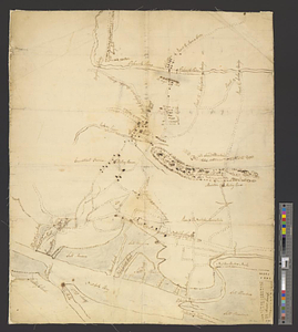
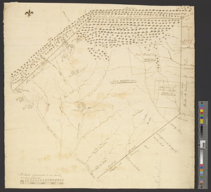
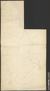
Part of the city of New York, 27th Augt: 1778 [and] part of Long Island
549.
Part of the counties of Charlotte and Albany, in the province of New York; being the seat of war between the king's forces...
550.
Part of the modern counties of Bergen, Passaic, and Sussex, New Jersey
551.
Part of the modern counties of Burlington and Camden, New Jersey
552.
Part of the modern counties of Currituck, Camden, and Pasquotank, North Carolina
553.
Part of the modern counties of Dutchess, Putnam, and Westchester
554.
Part of the modern counties of Essex and Hudson, New Jersey
555.
Part of the modern counties of Hudson and Bergen, New Jersey
556.
Part of the modern counties of Litchfield and Fairfield, Connecticut, and Westchester and Putnam, New York
557.
Part of the modern counties of Manhattan, Westchester and Queens
558.
Part of the modern counties of Monmouth, Middlesex, Somerset, Hunterdon, Mercer, Burlington, and Ocean in New Jersey and...
559.
Part of the modern counties of Oconee, Pickens, Anderson, and Greenville
560.
Part of the modern counties of Philadelphia, Bucks, Chester, Montgomery, Lehigh, Northampton, Lancaster, and Lebanon
‹ Prev
Next ›
1
2
…
24
25
26
27
28
29
30
31
32
…
47
48

![Part of the city of New York, 27th Augt: 1778 [and] part of Long Island](https://bpldcassets.blob.core.windows.net/derivatives/metadata/commonwealth-oai:6d573t30q/image_thumbnail_300.jpg)