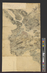
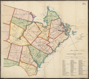
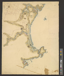
Part of modern Rockingham County (N.H.) and Essex County (Mass.)
This map is also available in American Revolutionary Geographies Online (ARGO), a collections portal especially built for material relating to the American Revolutionary War Era. Visit ARGO to learn more about this item and explore the historical geography of North America in the late eighteenth century.
Item Information
- Title:
- Part of modern Rockingham County (N.H.) and Essex County (Mass.)
- Date:
-
[1770–1779]
- Format:
-
Maps/Atlases
- Genre:
-
Manuscript maps
- Location:
- William L. Clements Library
- Collection (local):
-
William L. Clements Library Collection
- Subjects:
-
Rockingham County (N.H.)--Maps
Essex County (Mass.)--Maps
- Places:
-
New HampshireRockingham (county)
MassachusettsEssex (county)
- Extent:
- 1 ms. map : col. ; 65.8 x 50 cm
- Terms of Use:
-
The University of Michigan Library provides access to these materials for educational and research purposes. These materials may be under copyright. If you decide to use any of these materials, you are responsible for making your own legal assessment and securing any necessary permission. If you have questions about the collection, please contact the William L. Clements Library.
Contact host institution for more information.
- Scale:
-
Scale ca. 1:126,720.
- Language:
-
English
- Catalog Record:
-
Catalog record
- Notes:
-
Finished, colored topographical map of the coast from Portsmouth to Gloucester indicating towns, houses, roads, and rivers.
Penciled at left: Portsmouth New Hampshire [and] Newbury Massachusetts.
Clinton Maps 39.
- Notes (date):
-
This date is inferred.
- Identifier:
-
8272
- Barcode:
-
B1937575