Toggle navigation
LMEC Home
Exhibitions
Georeferencing
Tools for Teachers
Collections
My Favorites
Sign Up / Log In
Search
Search the map portal
Map Collection
Map Collection
Map Sets
Search
Search
Search for
Search In
All Fields
Creator
Title
Subject
Place
Search All Digital Collections
Advanced Search
337 Results
My Search
Start Over
More Like
commonwealth:z603vv407
Remove constraint More Like: commonwealth:z603vv407
Filter your Search
Place
North and Central America
270
United States
208
Suffolk (county)
72
Boston
70
Massachusetts
38
New York
32
Canada
28
North America
27
more
Place
»
Topic
Boston (Mass.)--Maps--Early works to 1800
46
Boston Harbor (Mass.)--Maps--Early works to 1800
21
Boston (Mass.)--History--Revolution, 1775-1783--Maps--Early works to 1800
19
North America--Maps--Early works to 1800
18
New England--Maps--Early works to 1800
11
United States--History--Revolution, 1775-1783--Maps--Early works to 1800
11
Vues d'optique
10
Fortification--Massachusetts--Boston--Maps--Early works to 1800
9
more
Topic
»
Date
Date range begin
–
Date range end
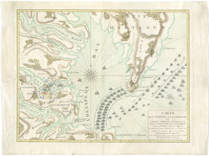
Current results range from
1694
to
1879
View distribution
Creator
Faden, William, 1749-1836
33
Jefferys, Thomas, -1771
30
Le Rouge, Georges-Louis
24
Des Barres, Joseph F. W. (Joseph Frederick Wallet), 1722-1824
22
Sayer, Robert, 1725-1794
19
Korn, Christoph Heinrich, 1726-1783
11
Raspe, Gabriel Nicolaus, 1712-1785
11
Simcoe, John Graves, 1752-1806
10
more
Creator
»
Format
Maps/Atlases
294
Prints
32
Manuscripts
25
Drawings/Illustrations
9
Books
2
Georeferenced
Yes
18
No
319
Collection
American Revolutionary War-Era Maps
327
Richard H. Brown Revolutionary War Map Collection at Mount Vernon
293
Boston and New England Maps
41
Norman B. Leventhal Map & Education Center Collection
38
Urban Maps
25
Mapping Boston Collection
8
Maritime Charts and Atlases
6
Library of Congress Collection
3
more
Collection
»
Available to use
Creative Commons license
305
No known restrictions
32
Search Constraints
Sort by date (desc)
relevance
title
date (asc)
date (desc)
Number of results to display per page
20 per page
10
per page
20
per page
50
per page
100
per page
View results as:
grid view
map view
Search Results
61.
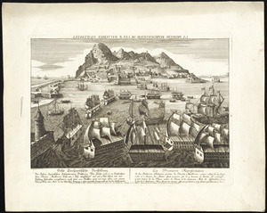
La premiere representation de les X batteries flottantes
62.
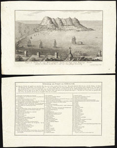
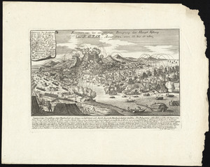
Prospect von Gibraltar mit seinen werken, umliegenden gegenden und iezigen neuern belagerungs anstalten : gezeichnet vor...
63.
Province de New-Jersey divisée en est et ouest nomée vulgairement les Jerseys
64.
Relation von der vergeblichen belagrung der haupt vestung Gibraltar : anno 1782 von 13 bis 17 sbre
65.
Suite du theatre de la guerre dans l'Amérique Septentrionale y compris le Golfe du Méxique
66.
To His Excellency Genl. Washington, Commander in Chief of the armies of the United States of America : this plan of the...
67.
Carte de la partie de la Virginie ou l'armée combinée de France & des États-Unis de l'Amérique a fait prisonnière l'armée...
68.
Carte des environs du Fort Pitt et de la nouvelle province Indiana : dediée a M. Franklin
69.
A new map of the British colonies in North America, shewing the seat of the present war, taken from the best surveys, compared...
70.
Partie occidentale de la Virginie, Pensylvanie, Maryland, et Caroline septle. la Rivière d'Ohio, et toutes celles qui s'y...
71.
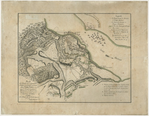
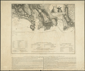
Plan de l'armée de Cornwallis attaquée et faitte prisoniere dans York Town : le 19 8bre par l'armée combinée Francaise et...
72.
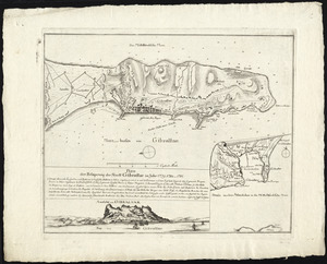
Plan der belagerung der stadt Gibraltar im jahr 1779, 1780, 1781
73.
Plan des environs de New York (manuscrit) - Position du camp de l'armée combinée à Philippsburg du 6 juillet au 19 août -...
74.
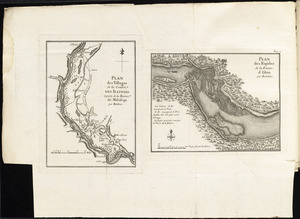
Plan des villages de la contrée des Illinois et partie de la Riviere de Mississipi ; plan des Rapides de la Riviere d'Ohio
75.
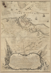
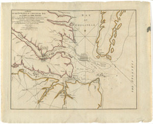
A plan of the entrance of Chesapeak Bay, with James and York rivers : wherein are shewn the respective positions (in the...
76.
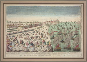
Reddition de l'armée Angloises commandée par Mylord Comte de Cornwallis aux armees combinées des Etats Unis de l'Amerique et...
77.
Sketch of part of the island of Ste. Lucie : computed at about 2500 feet to 1 inch
78.
Théatre de la guerre en Amerique, avec les Isles Antilles : projetté et assujettie aux observations
79.
Boston
80.
Boston
‹ Prev
Next ›
1
2
3
4
5
6
7
8
…
16
17