Toggle navigation
LMEC Home
Exhibitions
Georeferencing
Tools for Teachers
Collections
My Favorites
Sign Up / Log In
Search
Search the map portal
Map Collection
Map Collection
Map Sets
Search
Search
Search for
Search In
All Fields
Creator
Title
Subject
Place
Search All Digital Collections
Advanced Search
167 Results
My Search
Start Over
More Like
commonwealth:z603vq94q
Remove constraint More Like: commonwealth:z603vq94q
Filter your Search
Place
North and Central America
112
United States
112
North America
45
Canada
29
New Jersey
8
Northeastern United States
7
Middle Atlantic
6
Mississippi River
5
more
Place
»
Topic
United States--Maps--Early works to 1800
103
North America--Maps--Early works to 1800
37
Canada--Maps--Early works to 1800
27
Great Britain--Colonies--America--Maps--Early works to 1800
12
New Jersey--Maps--Early works to 1800
7
North America--Maps
7
Northeastern States--Maps--Early works to 1800
7
British--America--Maps--Early works to 1800
5
more
Topic
»
Date
Date range begin
–
Date range end
Current results range from
1707
to
1899
View distribution
Creator
Kitchin, Thomas, 1719-1784
10
Anville, Jean Baptiste Bourguignon d', 1697-1782
7
Faden, William, 1749-1836
7
Jefferys, Thomas, -1771
7
Lodge, John, -1796
6
Gibson, J. (John), active 1750-1792
5
Hinton, John, -1781
5
Robert Sayer and John Bennett (Firm)
5
more
Creator
»
Format
Maps/Atlases
167
Georeferenced
Yes
9
No
158
Collection
American Revolutionary War-Era Maps
157
New York Public Library Collection
78
MacLean Collection Map Library
43
Norman B. Leventhal Map & Education Center Collection
29
Richard H. Brown Revolutionary War Map Collection at Mount Vernon
9
New-York Historical Society Collection
4
Mapping Boston Collection
2
Boston Athenaeum, Cartographic Collection
1
more
Collection
»
Available to use
Creative Commons license
91
No known restrictions
31
Search Constraints
Sort by relevance
relevance
title
date (asc)
date (desc)
Number of results to display per page
20 per page
10
per page
20
per page
50
per page
100
per page
View results as:
grid view
map view
Search Results
81.
Partie des Etats-Unis de l'Amerique Septentrional
82.
Partie occidentale du Canada et septentrionale de la Louisiane avec une partie de la Pensilvanie
83.
Partie septentrionale des possessions angloise en Amérique : pour servire d'intelligence à la guerre présente entre les...
84.
Schauplatz des Kriegs zwischen Engelland und seinen Collonien in America
85.
Schauplatz des kriegs zwischen Engelland und seinen collonien in America
86.
States of America, drawn from the best authorities
87.
The theatre of war in North America, with the roads and a table of the distances
88.
Theatrum belli in America Septentrionali II. foliis comprehensum jussu Acad. Reg. Scient. et Eleg. Litt.
89.
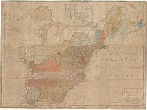
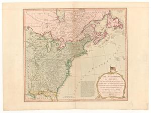
The United States of America
90.
The United States of America laid down from the best authorities, agreeable to the Peace of 1783
91.
The United States of America laid down from the best authorities, agreeable to the Peace of 1783
92.
The United States of America laid down from the best authorities, agreeable to the peace of 1783
93.
The United States of America laid down from the best authorities agreeable to the peace of 1783
94.
The United States of America with the British possessions of Canada, Nova Scotia, & of Newfoundland, divided with the French :...
95.
The United States of America with the British possessions of Canada, Nova Scotia, & of Newfoundland, divided with the French :...
96.
The United States of America with the British possessions of Canada, Nova Scotia, New Brunswick and Newfoundland divided with...
97.
The United States of America with the British possessions of Canada, Nova Scotia, New Brunswick and Newfoundland divided with...
98.
The United States of North America : with the British & Spanish territories according to the treaty
99.
The United States of North America : with the British territories and those of Spain according to the treaty of 1784
100.
The United States of North America, with the British & Spanish territories according to the treaty
‹ Prev
Next ›
1
2
3
4
5
6
7
8
9