Schauplatz des kriegs zwischen Engelland und seinen collonien in America
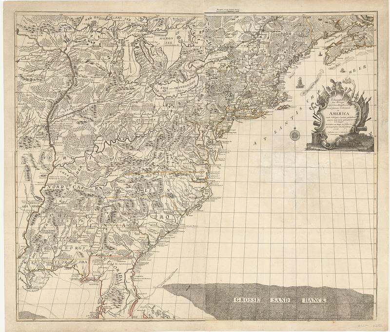
This map is also available in American Revolutionary Geographies Online (ARGO), a collections portal especially built for material relating to the American Revolutionary War Era. Visit ARGO to learn more about this item and explore the historical geography of North America in the late eighteenth century.
Item Information
- Title:
- Schauplatz des kriegs zwischen Engelland und seinen collonien in America
- Cartographer:
- Jaeger, Johann Christian
- Engraver:
- Berndt, Johann Christian, 1748-1812
- Name on Item:
-
nach richten carten gezeichnet und in diese form gebracht von I: C: Iaeger ; gestochen von I: C: Berndt in Franckfurt
- Date:
-
1776
- Format:
-
Maps/Atlases
- Location:
- MacLean Collection Map Library
- Collection (local):
-
MacLean Collection Map Library
- Subjects:
-
United States--Maps--Early works to 1800
- Places:
-
United States
- Extent:
- 1 map ; 635 x 744 mm
- Terms of Use:
-
Public Domain/No known restrictions on use. Contact host institution to download image.
Contact host institution for more information.
- Publisher:
-
Frankfurt-am-Main :
zu findern in der Iaegerischen Buchhandlung
- Edition:
- First state
- Language:
-
German
- Identifier:
-
MC_3918
- Call #:
-
3918


