Toggle navigation
LMEC Home
Exhibitions
Georeferencing
Tools for Teachers
Collections
My Favorites
Sign Up / Log In
Search
Search the map portal
Map Collection
Map Collection
Map Sets
Search
Search
Search for
Search In
All Fields
Creator
Title
Subject
Place
Search All Digital Collections
Advanced Search
231 Results
My Search
Start Over
More Like
commonwealth:z603vq08n
Remove constraint More Like: commonwealth:z603vq08n
Filter your Search
Place
North America
175
North and Central America
154
United States
55
Canada
17
New Jersey
9
South America
8
Middle Atlantic
7
New England
7
more
Place
»
Topic
North America--Maps--Early works to 1800
180
United States--Maps--Early works to 1800
24
Great Britain--Colonies--America--Maps--Early works to 1800
16
Canada--Maps--Early works to 1800
12
British--America--Maps--Early works to 1800
10
South America--Maps--Early works to 1800
8
New Jersey--Maps--Early works to 1800
7
North America--Maps
7
more
Topic
»
Date
Date range begin
–
Date range end
Current results range from
1528
to
1899
View distribution
Creator
Mitchell, John, 1711-1768
13
Jefferys, Thomas, -1771
12
Sayer, Robert, 1725-1794
12
Anville, Jean Baptiste Bourguignon d', 1697-1782
11
Moll, Herman, d. 1732
11
Kitchin, Thomas, 1718-1784
9
Gibson, J. (John), active 1750-1792
7
Hinton, John, -1781
7
more
Creator
»
Format
Maps/Atlases
231
Manuscripts
2
Georeferenced
Yes
10
No
221
Collection
American Revolutionary War-Era Maps
167
Norman B. Leventhal Map & Education Center Collection
112
New York Public Library Collection
82
Richard H. Brown Revolutionary War Map Collection at Mount Vernon
18
Mapping Boston Collection
9
Sidney R. Knafel Map Collection at Phillips Academy
8
British Library Collection
3
New-York Historical Society Collection
3
more
Collection
»
Available to use
Creative Commons license
114
No known restrictions
106
Search Constraints
Sort by date (desc)
relevance
title
date (asc)
date (desc)
Number of results to display per page
20 per page
10
per page
20
per page
50
per page
100
per page
View results as:
grid view
map view
Search Results
61.
North America
62.
Carte du theatre de la guerre presente en Amerique
63.
Carte du theatre de la guerre presente en Amerique
64.
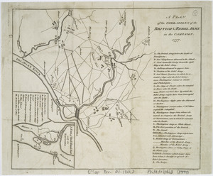
A plan of the operations of the British & Rebel army in the Campaign, 1777
65.
Le Colonie Unite dell' America Settentr'le di nuova projezione a ss. ee. li signori riformatori dello studio di Padova : con...
66.
An exact map of New England, New York, Pensylvania & New Jersey, from the latest surveys
67.
An exact map of New Jersey, Pensylvania [sic], New York, Maryland & Virginia, from the latest surveys
68.
A new & accurate map of North America : drawn from the most authentic modern maps and charts
69.
La Pensilvania, la Nuova York, il Jersey Settentrio[na]le : con la parte occidentale del Connecticut, Massachusset-s-bay e...
70.
The Province of New Jersey : divided into East and West, commonly called the Jerseys
71.
Amérique septentrionale avec les routes, distances en miles, villages, et etablissements François et Anglois
72.
Carte de l'Amérique Septle. pour servir à l'intelligence de la guerre entre les Anglois et les insurgents
73.
Carte des possessions angloises dans l'Amerique Septentrionale pour servir d'intelligence à la guerre presente traduite de...
74.
Carte detaillée des possessions angloises dans l'Amerique Septentrionale : construite d'après les dernieres relations et les...
75.
A new and correct map of North America with the West India Islands : divided according to the last treaty of peace, concluded...
76.
Seat of war in the environs of Philadeliphia
77.
Seat of war in the environs of Philadeliphia
78.
An Accurate map of the present seat of war between Great-Britain and her colonies in North America
79.
Acurate charte von Nord-America : aus dem besten quellen
80.
L'Amérique Septentrionale
‹ Prev
Next ›
1
2
3
4
5
6
7
8
…
11
12


![An exact map of New Jersey, Pensylvania [sic], New York, Maryland & Virginia, from the latest surveys](https://bpldcassets.blob.core.windows.net/derivatives/images/commonwealth:z603vp67m/image_thumbnail_300.jpg)

![La Pensilvania, la Nuova York, il Jersey Settentrio[na]le](https://bpldcassets.blob.core.windows.net/derivatives/images/commonwealth:z603vq53g/image_thumbnail_300.jpg)