Toggle navigation
LMEC Home
Exhibitions
Georeferencing
Tools for Teachers
Collections
My Favorites
Sign Up / Log In
Search
Search the map portal
Map Collection
Map Collection
Map Sets
Search
Search
Search for
Search In
All Fields
Creator
Title
Subject
Place
Search All Digital Collections
Advanced Search
143 Results
My Search
Start Over
More Like
commonwealth:z603vp90d
Remove constraint More Like: commonwealth:z603vp90d
Filter your Search
Place
United States
108
North and Central America
103
North America
37
Canada
30
Mississippi River
8
Louisiana
6
Northeastern United States
5
Ohio River
4
more
Place
»
Topic
United States--Maps--Early works to 1800
103
North America--Maps--Early works to 1800
33
Canada--Maps--Early works to 1800
28
Great Britain--Colonies--America--Maps--Early works to 1800
22
Mississippi River Valley--Maps--Early works to 1800
8
France--Colonies--America--Maps--Early works to 1800
7
Northeastern States--Maps--Early works to 1800
6
Louisiana--Maps--Early works to 1800
5
more
Topic
»
Date
Date range begin
–
Date range end
Current results range from
1707
to
1830
View distribution
Creator
Faden, William, 1749-1836
6
Robert Sayer and John Bennett (Firm)
6
Anville, Jean Baptiste Bourguignon d', 1697-1782
5
Hinton, John, -1781
5
Kitchin, Thomas, 1719-1784
5
Bellin, Jacques Nicolas, 1703-1772
4
Conder, Thomas, 1746 or 1747-1831
4
Evans, Lewis, 1700?-1756
4
more
Creator
»
Format
Maps/Atlases
143
Georeferenced
Yes
6
No
137
Collection
American Revolutionary War-Era Maps
131
MacLean Collection Map Library
47
New York Public Library Collection
40
Norman B. Leventhal Map & Education Center Collection
36
Richard H. Brown Revolutionary War Map Collection at Mount Vernon
12
New-York Historical Society Collection
4
Mapping Boston Collection
2
Boston Athenaeum, Cartographic Collection
1
more
Collection
»
Available to use
Creative Commons license
56
No known restrictions
38
Search Constraints
Sort by relevance
relevance
title
date (asc)
date (desc)
Number of results to display per page
20 per page
10
per page
20
per page
50
per page
100
per page
View results as:
grid view
map view
Search Results
1.
Amplissimae regionis Mississipi seu provinciae Ludovicianae â R.P. Ludovico Hennepin Francisc. Miss. in America septentrionali...
2.
Amplissimae regionis Mississipi seu Provinciae Ludovicianae â R.P. Ludovico Hennepin Francisc Miss in America Septentrionali...
3.
Carte de la Louisiane et du cours de Mississipi
4.
A map of Carolana and of the river Meschacebe &c
5.
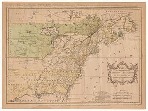
Carte nouvelle de l'Amérique Angloise contenant tout ce que les Anglois possédent sur le continent de l'Amérique...
6.
A Map of the British American plantations, extending from Boston in New England to Georgia : including all the back settlements...
7.
A new and correct map of North America with the West India Islands : divided according to the last treaty of peace, concluded...
8.
An accurate map of the British Empire in Nth. America as settled by the preliminaries in 1762
9.
A map of Louisiana and of the River Mississipi
10.
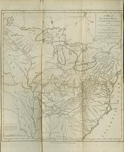
A map of the western part of the territories belonging to the United States of America : drawn from the best authorities
11.
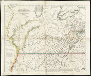
A new map of the western parts of Virginia, Pennsylvania, Maryland and North Carolina : comprehending the river Ohio, and all...
12.
Partie occidentale de la Virginie, Pensylvanie, Maryland, et Caroline septle. la Rivière d'Ohio, et toutes celles qui s'y...
13.
An accurate map of the British, French & Spanish settlements in Nth. America and the West Indies : as stipulated by the...
14.
An Accurate map of the present seat of war between Great-Britain and her colonies in North America
15.
Amérique septentrionale avec les routes, distances en miles, villages, et etablissements François et Anglois
16.
Carte des possessions angloises & françoises du continent de l'Amérique Septentrionale = A map of the British and French...
17.
Carte du Canada ou de la Nouvelle France et des decouvertes qui y ont été faites
18.
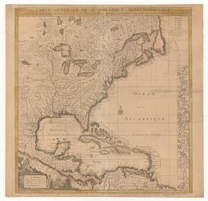
Carte générale de l'Amérique séptentrionale : avec les posséssions Angloises dans cette partie du nouveau monde
19.
Carte générale de l'Amérique séptentrionale avec les posséssions angloises dans cette partie du nouveau monde
20.
A general map of the middle British colonies in America, viz. Virginia, Maryland, Delaware, Pensilvania, New-Jersey, New York,...
‹ Prev
Next ›
1
2
3
4
5
…
7
8