Toggle navigation
LMEC Home
Exhibitions
Georeferencing
Tools for Teachers
Collections
My Favorites
Sign Up / Log In
Search
Search the map portal
Map Collection
Map Collection
Map Sets
Search
Search
Search for
Search In
All Fields
Creator
Title
Subject
Place
Search All Digital Collections
Advanced Search
198 Results
My Search
Start Over
More Like
commonwealth:z603vp41g
Remove constraint More Like: commonwealth:z603vp41g
Filter your Search
Place
North America
171
North and Central America
50
United States
33
Canada
17
South America
9
New England
6
New York
6
West Indies
6
more
Place
»
Topic
North America--Maps--Early works to 1800
180
Great Britain--Colonies--America--Maps--Early works to 1800
19
United States--Maps--Early works to 1800
14
Canada--Maps--Early works to 1800
12
British--America--Maps--Early works to 1800
10
South America--Maps--Early works to 1800
8
France--Colonies--America--Maps--Early works to 1800
7
West Indies--Maps--Early works to 1800
6
more
Topic
»
Date
Date range begin
–
Date range end
Current results range from
1528
to
1850
View distribution
Creator
Mitchell, John, 1711-1768
13
Jefferys, Thomas, -1771
12
Sayer, Robert, 1725-1794
12
Moll, Herman, d. 1732
11
Anville, Jean Baptiste Bourguignon d', 1697-1782
9
Kitchin, Thomas, 1718-1784
6
Hinton, John, -1781
5
Kitchin, Thomas, d. 1784
5
more
Creator
»
Format
Maps/Atlases
198
Manuscripts
2
Georeferenced
Yes
5
No
193
Collection
American Revolutionary War-Era Maps
133
Norman B. Leventhal Map Center Collection
115
New York Public Library Collection
46
Richard H. Brown Revolutionary War Map Collection at Mount Vernon
18
Mapping Boston Collection
9
Sidney R. Knafel Map Collection at Phillips Academy
8
British Library Collection
3
New-York Historical Society Collection
3
more
Collection
»
Available to use
No known restrictions
109
Creative Commons license
78
Search Constraints
Sort by date (desc)
relevance
title
date (asc)
date (desc)
Number of results to display per page
20 per page
10
per page
20
per page
50
per page
100
per page
View results as:
grid view
map view
Search Results
101.
A new and accurate map of the English empire in North America : representing their rightful claim as confirm'd by charters, and...
102.
L'Amérique septentrionale
103.
A map of Maryland with the Delaware counties and the southern part of New Jersey &c
104.
America Septentrionalis a Domino d'Anville in Galliis edita nunc in Anglia : Coloniis in interiorem Virginiam deductis nec non...
105.
Amérique septentrionale avec les routes, distances en miles, limites et etablissements françois et anglois
106.
A map of the British and French dominions in North America with the roads, distances, limits, and extent of the settlements,...
107.
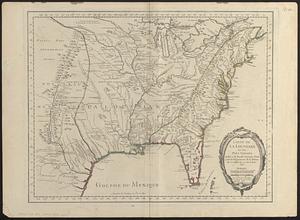
Carte de la Louisiane et des pays voisins : dédiée à M. Rouillé, sécretaire d'État, ayant le Département de la marine
108.
Carte de la Louisiane et des pays voisins dédiée à M. Rouillé sécretaire d'état, ayant le Département de la marine
109.
Carte de l'Amérique septentrionale, 1754
110.
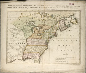
Carte des possessions angloises & françoises du continent de l'Amérique septentrionale = Kaart van de Engelsche en Fransche...
111.
Carte générale de l'Amérique séptentrionale : avec les posséssions Angloises dans cette partie du nouveau monde
112.
Extract from a map of the British and French dominions in North America
113.
A map of the British and French dominions in North America : with the roads, distances, limits, and extent of the settlements
114.
A map of the British and French dominions in North America : with the roads, distances, limits, and extent of the settlements,...
115.
A map of the British and French dominions in North America : with the roads, distances, limits, and extent of the settlements,...
116.
A map of the British and French dominions in North America : with the roads, distances, limits, and extent of the settlements,...
117.
A map of the British and French dominions in North America, with the roads, distances, limits, and extent of the settlements
118.
A map of the British and French dominions in North America with the roads, distances, limits, and extent of the settlements,...
119.
A Map of the British and French settlements in North America : (part the second) containing part of New York, Pensilvania, New...
120.
A Map of the British and French settlements in North America
‹ Prev
Next ›
1
2
3
4
5
6
7
8
9
10