Toggle navigation
LMEC Home
Exhibitions
Georeferencing
Tools for Teachers
Collections
My Favorites
Sign Up / Log In
Search
Search the map portal
Map Collection
Map Collection
Map Sets
Search
Search
Search for
Search In
All Fields
Creator
Title
Subject
Place
Search All Digital Collections
Advanced Search
450 Results
My Search
Start Over
More Like
commonwealth:z603vh06v
Remove constraint More Like: commonwealth:z603vh06v
Filter your Search
Place
North and Central America
413
United States
356
Canada
36
North America
29
West Indies
23
New York
12
Boston
11
New England
11
more
Place
»
Topic
United States--Maps
330
Elections--United States--Maps
36
Railroads--United States--Maps
34
North America--Maps
28
Canada--Maps
25
West Indies--Maps
24
Population density--United States--Maps
14
New England--Maps
11
more
Topic
»
Date
Date range begin
–
Date range end
Current results range from
1750
to
2023
View distribution
Creator
Paullin, Charles Oscar, 1868 or 1869-1944
70
Wright, John Kirtland, 1891-1969
70
Geological Survey (U.S.)
15
Reid, John, 1764?-1828
11
Farwell, John Whittemore, 1843-1929
9
Bellin, Jacques Nicolas, 1703-1772
8
Carleton, Osgood, 1742-1816
8
Kitchin, Thomas, 1719-1784
8
more
Creator
»
Format
Maps/Atlases
448
Manuscripts
13
Prints
2
Books
1
Objects/Artifacts
1
Posters
1
Georeferenced
Yes
75
No
375
Collection
Norman B. Leventhal Map & Education Center Collection
288
American Revolutionary War-Era Maps
161
American Antiquarian Society Collection
138
William L. Clements Library Collection
13
MacLean Collection Map Library
10
David Judkins Weaver Papers
2
Mapping Boston Collection
2
Applied Geographics, Inc. Records
1
more
Collection
»
Available to use
No known restrictions
213
Creative Commons license
6
Search Constraints
Sort by relevance
relevance
title
date (asc)
date (desc)
Number of results to display per page
20 per page
10
per page
20
per page
50
per page
100
per page
View results as:
grid view
map view
Search Results
41.
Cantonment of the forces in N. America 1766
42.
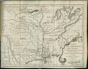
Carte de la Louisiane colonie francaise avec le cours du fleuve St. Louis, les rivieres adjacentes, les nations des naturels,...
43.
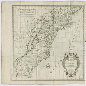
Carte des Etats-Unis
44.
Carte des Etats-Unis de l'Amérique-Nord : pour servir aux observations géologiqueir
45.
Carte générale des États-Unis de l'Amérique avec les plans des principales villes
46.
Carte generale des treize Etats-Unis & independants de l'Amerique Septentrional
47.
Case's map of the United States, the British provinces, Mexico, and part of the West Indies : compiled from the latest...
48.
Catholic America : a pictorial map portraying the contribution of Catholics in the development of the United States of America...
49.
Civil airways of the United States as designated in Civil Air Regulations - chapter 60
50.
Clemens' silent teacher, dissected map of the United States and of each state in counties
51.
Colton's general map of the United States : showing the railroad routes across the continent
52.
Colton's map of the United States of America, the British provinces, Mexico and the West Indies : showing the country from the...
53.
Colton's new railroad map of the United States & Canada
54.
Colton's plans of U.S. harbors : showing the position & vicinities of the most important fortifications on the sea-board and in...
55.
Complete map of the rail roads and water courses in the United States & Canada
56.
Compromise of 1850, September 6, 1850, vote on passage of Texas-New Mexico provisions
57.
Density of population, 1790
58.
Density of population, 1800
59.
Density of population, 1810
60.
Density of population, 1820
‹ Prev
Next ›
1
2
3
4
5
6
7
…
22
23