Toggle navigation
LMEC Home
Exhibitions
Georeferencing
Tools for Teachers
Collections
My Favorites
Sign Up / Log In
Search
Search the map portal
Map Collection
Map Collection
Map Sets
Search
Search
Search for
Search In
All Fields
Creator
Title
Subject
Place
Search All Digital Collections
Advanced Search
298 Results
My Search
Start Over
More Like
commonwealth:z603vg80x
Remove constraint More Like: commonwealth:z603vg80x
Filter your Search
Place
North and Central America
285
United States
228
New England
124
Canada
69
Massachusetts
34
New York
30
North America
22
West Indies
17
more
Place
»
Topic
New England--Maps
127
Canada--Maps
55
Railroads--New England--Maps
50
United States--Maps
33
New York (State)--Maps
25
North America--Maps
21
Massachusetts--Maps
17
West Indies--Maps
17
more
Topic
»
Date
Date range begin
–
Date range end
Current results range from
1706
to
2015
View distribution
Creator
Reid, John, 1764?-1828
11
Bellin, Jacques Nicolas, 1703-1772
10
Farwell, John Whittemore, 1843-1929
9
Kitchin, Thomas, 1719-1784
9
Carleton, Osgood, 1742-1816
6
Gibson, J. (John), active 1750-1792
6
Jefferys, Thomas, -1771
6
Tanner, Benjamin, 1775-1848
6
more
Creator
»
Format
Maps/Atlases
298
Manuscripts
13
Georeferenced
Yes
32
No
266
Collection
American Revolutionary War-Era Maps
151
Norman B. Leventhal Map & Education Center Collection
141
Maps from AAS
138
Boston and New England Maps
79
William L. Clements Library Collection
9
David Judkins Weaver Papers
4
Sidney R. Knafel Map Collection at Phillips Academy
4
MacLean Collection Map Library
3
more
Collection
»
Available to use
No known restrictions
141
Creative Commons license
4
Search Constraints
Sort by relevance
relevance
title
date (asc)
date (desc)
Number of results to display per page
20 per page
10
per page
20
per page
50
per page
100
per page
View results as:
grid view
map view
Search Results
101.
Map of New England : with adjacent portions of New York & Canada
102.
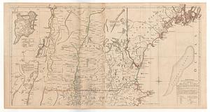
[Map of New England, 31st]
103.
Map of New England exhibiting the rail road & telegraphic lines now in operation
104.
Map of New England exhibiting the rail road and telegraphic lines now in operation
105.
Map of New England with adjacent portions of New York & Canada
106.
Map of New England with adjacent portions of New York & Canada
107.
Map of New England with adjacent portions of New York & Canada
108.
Map of the Boston & Maine Railroad, showing its relative position & connection with other railroads
109.
Map of the Boston and Northwestern, Massachusetts Central, and Boston and Poughkeepsie Railroads and their connections
110.
Map of the Boston, Concord, Montreal & White Mountains Railroad and its principal connections
111.
Map of the British and French dominions in North America, drawn by order of the British government in 1755, showing what that...
112.
Map of the country copied from Hale's map of N. E. with railroad route from Boston to Lake Champlain : through Keene, N. H
113.
Map of the eastern and middle states
114.
Map of the Eastern Railroad and principal connections
115.
A map of the most inhabited part of New England containing the provinces of Massachusets Bay and New Hampshire with the...
116.
Map of the New England and Middle Atlantic States
117.
A map of the New England states : Maine, New Hampshire, Vermont, Massachusetts, Rhode Island & Connecticut, with the adjacent...
118.
A map of the New England states : Maine, New Hampshire, Vermont, Massachusetts, Rhode Island & Connecticut, with the adjacent...
119.
Map of the New York & Boston Railway, with its connections with other railways
120.
Map of the northern part of New England : compiled for Pres't. Dwight's travels
‹ Prev
Next ›
1
2
3
4
5
6
7
8
9
10
…
14
15

![[Map of New England, 31st]](https://bpldcassets.blob.core.windows.net/derivatives/images/commonwealth:wd3763094/image_thumbnail_300.jpg)