Toggle navigation
LMEC Home
Exhibitions
Georeferencing
Tools for Teachers
Collections
My Favorites
Sign Up / Log In
Search
Search the map portal
Map Collection
Map Collection
Map Sets
Search
Search
Search for
Search In
All Fields
Creator
Title
Subject
Place
Search All Digital Collections
Advanced Search
214 Results
My Search
Start Over
More Like
commonwealth:z603vg25v
Remove constraint More Like: commonwealth:z603vg25v
Filter your Search
Place
North and Central America
180
United States
124
Louisiana
36
Southern United States
28
Florida
25
Canada
22
West Indies
19
North America
17
more
Place
»
Topic
Louisiana--Maps
36
Southern States--Maps
29
Florida--Maps
25
United States--Maps
20
West Indies--Maps
19
North America--Maps
17
Canada--Maps
14
Boston (Mass.)--Maps
9
more
Topic
»
Date
Date range begin
–
Date range end
Current results range from
1749
to
1986
View distribution
Creator
Geological Survey (U.S.)
11
Reid, John, 1764?-1828
11
Farwell, John Whittemore, 1843-1929
9
Kitchin, Thomas, 1719-1784
9
United States. Post Office Dept
9
Bellin, Jacques Nicolas, 1703-1772
8
Carleton, Osgood, 1742-1816
6
Tanner, Benjamin, 1775-1848
6
more
Creator
»
Format
Maps/Atlases
214
Manuscripts
12
Georeferenced
Yes
29
No
185
Collection
American Revolutionary War-Era Maps
151
American Antiquarian Society Collection
138
Norman B. Leventhal Map & Education Center Collection
62
William L. Clements Library Collection
11
MacLean Collection Map Library
2
Boston and New England Maps
1
Maritime Charts and Atlases
1
New York Public Library Collection
1
Available to use
No known restrictions
61
Creative Commons license
3
Search Constraints
Sort by relevance
relevance
title
date (asc)
date (desc)
Number of results to display per page
20 per page
10
per page
20
per page
50
per page
100
per page
View results as:
grid view
map view
Search Results
81.
Scarborough's new county and post office map of Louisiana and Mississippi : with complete index giving population and location...
82.
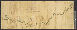
A sketch of the river Missisippi from New Orleans to the Rock of Davion
83.
State of Louisiana
84.
A survey of the Mississippi River
85.
1st. sheet of De Witt's state-map of New York
86.
An accurate map of North America
87.
An accurate map, of the District of Maine : being part of the commonwealth of Massachusetts
88.
An Accurate map of the United States of America. : According to the Treaty of Peace of 1783
89.
An accurate map of the West Indies, : containing the Bahama & Carribe islands, the Great & Little Antilles, with the Leward and...
90.
An accurate map of the West Indies
91.
An Accurate map of the West Indies, with the adjacent coast
92.
An accurate map of the West Indies with the adjacent coast of America
93.
An Accurate map of the West Indies with the adjacent coast of America. 1796
94.
An accurate plan of the town of Boston and its vicinity : exhibiting a ground plan of all the streets, lanes, alleys, wharves,...
95.
America Septentrionalis : a Domino d'Anville in Galliis edita nune in Anglia Coloniss in Interiorem Virginiam deductis nec non...
96.
Amerique Septentrionale
97.
Amplissima regionis Mississipi : seu provinciae Ludoviciana à R.P. Ludovico Hennepin Francise Miss. in America Septentrionali...
98.
Boston its environs and harbour, : with the rebels works raised against that town in 1775, from the observations of Lieut. Page...
99.
The British governments in Nth. America : laid down agreeable to the proclamation of Octr. 7, 1763
100.
Carte de la Caroline et Georgie. : Pour servir à l'Histoire générale des voyages
‹ Prev
Next ›
1
2
3
4
5
6
7
8
9
10
11