Toggle navigation
LMEC Home
Exhibitions
Georeferencing
Tools for Teachers
Collections
My Favorites
Sign Up / Log In
Search
Search the map portal
Map Collection
Map Collection
Map Sets
Search
Search
Search for
Search In
All Fields
Creator
Title
Subject
Place
Search All Digital Collections
Advanced Search
962 Results
My Search
Start Over
More Like
commonwealth:z603vg06n
Remove constraint More Like: commonwealth:z603vg06n
Filter your Search
Place
North and Central America
927
United States
854
Boston
743
Suffolk (county)
743
Massachusetts
636
New York
55
Downtown Boston
35
South Carolina
26
more
Place
»
Topic
Boston (Mass.)--Maps
752
City planning--Massachusetts--Boston--Maps
104
Real property--Massachusetts--Boston--Maps
99
Landowners--Massachusetts--Boston--Maps
74
Urban renewal--Massachusetts--Boston--Maps
63
Massachusetts--Maps
50
New York (N.Y.)--Maps
48
Local transit--Massachusetts--Boston--Maps
47
more
Topic
»
Date
Date range begin
–
Date range end
Current results range from
1740
to
2023
View distribution
Creator
Boston Redevelopment Authority
114
Geo. H. Walker & Co
27
Boynton, George W., d. 1884
21
Sampson, Davenport & Co
21
Sampson, Murdock & Co
20
Bromley, George Washington
18
Bromley, Walter Scott
17
Lufkin, Richard F. (Richard Friend)
17
more
Creator
»
Format
Maps/Atlases
962
Manuscripts
22
Georeferenced
Yes
115
No
847
Collection
Norman B. Leventhal Map & Education Center Collection
657
Boston and New England Maps
580
Urban Maps
517
American Revolutionary War-Era Maps
190
American Antiquarian Society Collection
138
Boston Redevelopment Authority Collection
120
William L. Clements Library Collection
42
Mapping Boston Collection
20
more
Collection
»
Available to use
No known restrictions
730
Creative Commons license
37
Search Constraints
Sort by relevance
relevance
title
date (asc)
date (desc)
Number of results to display per page
20 per page
10
per page
20
per page
50
per page
100
per page
View results as:
grid view
map view
Search Results
1.
A new chart of America : with the harbors, of Port Royal and Savannah &c
2.
A Plan of Charles Town the capitol of South Carolina, : with the harbour, islands, and forts; the attack on Fort Sulivan, by...
3.
[Plan of New York] : To the Honble. John Sullivan Esqr. Major Genl. in the army of the United States of America humbly...
4.
A Plan of the city of New York
5.
The provinces of New York, and New Jersey, : with part of Pensilvania [sic], and the province of Quebec
6.
Carte générale des États-Unis de l'Amérique avec les plans des principales villes
7.
Map of New York and vicinity
8.
Various plans and draughts of cities, towns, harbours &c
9.
An accurate plan of the town of Boston and its vicinity : exhibiting a ground plan of all the streets, lanes, alleys, wharves,...
10.
[Chart of Boston Harbor and the surrounding areas]
11.
A map of the coast of New England from Staten Island to the island of Breton
12.
Plan de Boston : cette ville est composée de quatre mille maisons, et d'environ vingt mille habitans
13.
A Plan of Boston, and its environs. : Shewing the true situation of His Majesty's army. And also those of the rebels
14.
A plan of the town and harbour of Boston. : And the country adjacent with the road from Boston to Concord shewing the place of...
15.
A Plan of the town of Boston, in New-England, : distinguishing that part which was burnt in 1760
16.
The Seat of war, in New England
17.
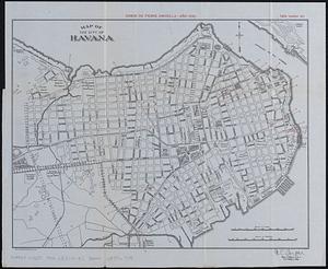
Map of Havana and Havana Harbor showing the fortifications and public buildings
18.
Map of the city of Havana : [casos de fiebre amarilla, muertes de niños menores, y muertes de tuberculosis]
19.
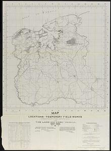
Map showing locations of temporary field works erected by the Spanish for the land defense of Havana, 1897-1898
20.
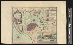
Neu und verbesseter plan der st. u. hafens Havanah auf der ins. Cvba mit den wasser tiefen, sand, baencken und klippen...
‹ Prev
Next ›
1
2
3
4
5
…
48
49


![[Plan of New York]](https://bpldcassets.blob.core.windows.net/derivatives/images/commonwealth:6108vt38k/image_thumbnail_300.jpg)


![[Chart of Boston Harbor and the surrounding areas]](https://bpldcassets.blob.core.windows.net/derivatives/images/commonwealth:6108vs71d/image_thumbnail_300.jpg)