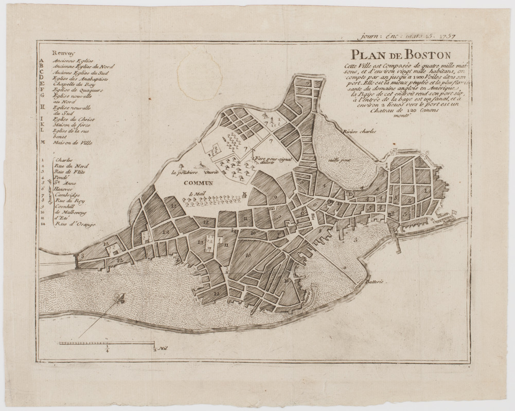
Plan de Boston : cette ville est composée de quatre mille maisons, et d'environ vingt mille habitans
This map is also available in American Revolutionary Geographies Online (ARGO), a collections portal especially built for material relating to the American Revolutionary War Era. Visit ARGO to learn more about this item and explore the historical geography of North America in the late eighteenth century.
Item Information
- Title:
- Plan de Boston : cette ville est composée de quatre mille maisons, et d'environ vingt mille habitans
- Description:
-
Subject: Plan of the city of Boston.
- Date:
-
[1757]
- Format:
-
Maps/Atlases
- Location:
- American Antiquarian Society
- Collection (local):
-
American Antiquarian Society Collection
- Subjects:
-
Boston (Mass.)--Maps
- Places:
-
Suffolk (county)Boston
- Extent:
- 1 map : engraving ; 18 x 25 cm., on sheet 23 x 29 cm.
- Terms of Use:
-
Public Domain/No known restrictions on use. Contact host institution to download image.
Contact host institution for more information.
- Publisher:
-
Liege, Belgium :
[s.n.]
- Scale:
-
Scale [ca. 1:14,900]
- Language:
-
French
- Catalog Record:
-
http://catalog.mwa.org/vwebv/holdingsInfo?bibId=486973
- Notes:
-
Relief shown pictorially.
"Journ. enc. mars 15 1757."
From the Journal encyclopedique ou universal, Liege, March, 1757.
- Notes (date):
-
This date is inferred.

![[Chart of Boston Harbor and the surrounding areas]](https://bpldcassets.blob.core.windows.net/derivatives/images/commonwealth:6108vs71d/image_thumbnail_300.jpg)


