Toggle navigation
LMEC Home
Exhibitions
Georeferencing
Tools for Teachers
Collections
My Favorites
Sign Up / Log In
Search
Search the map portal
Map Collection
Map Collection
Map Sets
Search
Search
Search for
Search In
All Fields
Creator
Title
Subject
Place
Search All Digital Collections
Advanced Search
8743 Results
My Search
Start Over
More Like
commonwealth:xg94j203c
Remove constraint More Like: commonwealth:xg94j203c
Filter your Search
Place
North and Central America
5,966
United States
4,888
Massachusetts
2,079
Europe
1,396
Suffolk (county)
1,046
Boston
1,019
Canada
462
Asia
438
more
Place
»
Topic
Boston (Mass.)--Maps
586
United States--Maps
330
Real property--Massachusetts--Boston--Maps
175
Massachusetts--Maps
162
Landowners--Massachusetts--Boston--Maps
133
North America--Maps--Early works to 1800
103
New England--Maps
102
Europe--Maps
79
more
Topic
»
Date
Date range begin
–
Date range end
Current results range from
1482
to
2023
View distribution
Creator
United States. Hydrographic Office
595
O.H. Bailey & Co
148
Des Barres, Joseph F. W. (Joseph Frederick Wallet), 1722-1824
123
United States. Post Office Dept
120
Ptolemy, 2nd cent
100
Walling, Henry Francis, 1825-1888
94
Geological Survey (U.S.)
87
Jefferys, Thomas, -1771
85
more
Creator
»
Format
Maps/Atlases
8,683
Manuscripts
215
Prints
56
Books
36
Objects/Artifacts
10
Drawings/Illustrations
8
Posters
5
Georeferenced
Yes
870
No
7,873
Collection
Norman B. Leventhal Map & Education Center Collection
8,700
Boston and New England Maps
2,233
Urban Maps
2,023
Maritime Charts and Atlases
1,083
American Revolutionary War-Era Maps
657
Boston Redevelopment Authority Collection
87
American Antiquarian Society Collection
20
William L. Clements Library Collection
13
more
Collection
»
Available to use
No known restrictions
8,556
Creative Commons license
50
Search Constraints
Sort by relevance
relevance
title
date (asc)
date (desc)
Number of results to display per page
20 per page
10
per page
20
per page
50
per page
100
per page
View results as:
grid view
map view
Search Results
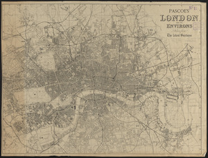
5981.
Pascoe's London and its environs, drawn from the latest surveys
5982.
Pashtunistan
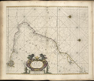
5983.
Paskaart van Brasil van Rio de los Amazones tot Rio de la Plata
5984.
Paskaart van de cust van Portugal, Barbaria en Genehoa : beginnende van d'Barlenges tot aan C. Verde met al zyn Diepte en...
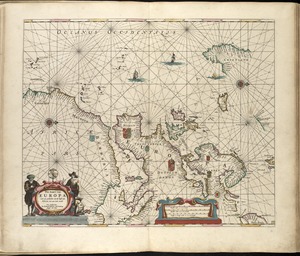
5985.
Pas-kaart van Europa met een gedeelte van de kust van Africa tot aen Cabo Verde
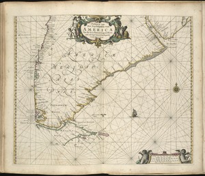
5986.
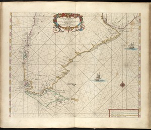
Paskaarte van Het Zuydelijckste van America van Rio de la Plata, tot Caap de Hoorn, ende inde Zuyd Zee, tot B. de Koquimbo
5987.
Paskaarte van't zuÿdelÿckste Deel van America, van Cabo St. Antonio, to Caep de Hoorn, en de inde Zuÿd Zee, tot B. de Tongoÿ
5988.
Paskaert van Brasilia van Pernambuco tot C. de S. Antonio
5989.
Paskaert van de Noordelijckste kuste van America van Groenland door de Straet Davis en de Straet Hudson tot Terra Neuf
5990.
Paskaerte van de Zuÿdt en Noordt Revier in Nieu Nederlant streckende van Cabo Hinloopen tot Rechkewach
5991.
Paskaerte van Nova Granada en t'Eylandt California
5992.
Paskaerte Zÿnde de Noordelijckfte Zeekuften van America van Groenland door de Straet Davis en de Straet Hudson tot Terra Neuf
5993.
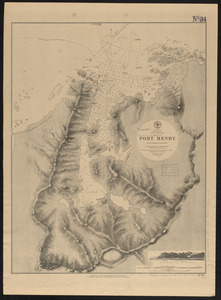
Patagonia w.c., Gulf of Trinidad, Port Henry : from a British survey in 1879
5994.
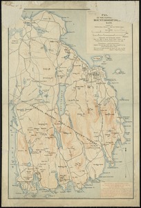
Path map of the eastern part of Mount Desert Island, Maine
5995.
Path map of the eastern part of Mount Desert Island, Maine
5996.
Path map of the eastern part of Mount Desert Island, Maine
5997.
Path map of the Eastern part of Mount Desert Island Maine
5998.
Path map of the eastern part of Mount Desert Island, Maine
5999.
Path map of the eastern part of Mount Desert Island, Maine
6000.
Pawtuxet, Rhode Island : 1890
‹ Prev
Next ›
1
2
…
296
297
298
299
300
301
302
303
304
…
437
438