Toggle navigation
LMEC Home
Exhibitions
Georeferencing
Tools for Teachers
Collections
My Favorites
Sign Up / Log In
Search
Search the map portal
Map Collection
Map Collection
Map Sets
Search
Search
Search for
Search In
All Fields
Creator
Title
Subject
Place
Search All Digital Collections
Advanced Search
8769 Results
My Search
Start Over
More Like
commonwealth:x633j6818
Remove constraint More Like: commonwealth:x633j6818
Filter your Search
Place
North and Central America
6,000
United States
4,916
Massachusetts
2,087
Europe
1,396
Suffolk (county)
1,047
Boston
1,020
Canada
451
Asia
438
more
Place
»
Topic
Boston (Mass.)--Maps
587
United States--Maps
284
Real property--Massachusetts--Boston--Maps
175
Massachusetts--Maps
171
Landowners--Massachusetts--Boston--Maps
133
New England--Maps
108
North America--Maps--Early works to 1800
103
Europe--Maps
79
more
Topic
»
Date
Date range begin
–
Date range end
Current results range from
1482
to
2023
View distribution
Creator
United States. Hydrographic Office
595
O.H. Bailey & Co
148
Des Barres, Joseph F. W. (Joseph Frederick Wallet), 1722-1824
123
United States. Post Office Dept
120
Ptolemy, 2nd cent
100
Walling, Henry Francis, 1825-1888
94
Geological Survey (U.S.)
91
Jefferys, Thomas, -1771
86
more
Creator
»
Format
Maps/Atlases
8,709
Manuscripts
216
Prints
56
Books
36
Objects/Artifacts
10
Drawings/Illustrations
8
Posters
5
Georeferenced
Yes
872
No
7,897
Collection
Norman B. Leventhal Map & Education Center Collection
8,702
Boston and New England Maps
2,240
Urban Maps
2,023
Maritime Charts and Atlases
1,083
American Revolutionary War-Era Maps
680
Boston Redevelopment Authority Collection
87
William L. Clements Library Collection
35
Maps from AAS
25
more
Collection
»
Available to use
No known restrictions
8,559
Creative Commons license
49
Search Constraints
Sort by relevance
relevance
title
date (asc)
date (desc)
Number of results to display per page
20 per page
10
per page
20
per page
50
per page
100
per page
View results as:
grid view
map view
Search Results
161.
A survey of the Mississippi River
162.
The Commonwealth of Connecticut
163.
Connecticut
164.
Connecticut
165.
Connecticut
166.
Connecticut
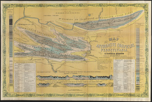
167.
Connecticut, from actual survey
168.
Connecticut from the best authorities
169.
Map of Connecticut
170.
Preliminary geological map of Connecticut
171.
The state of New York with part of the adjacent states
172.
Clemens' map of Pennsylvania
173.
Geological and topographical map of the anthracite fields of Pennsylvania : constructed from original explorations and surveys
174.
Geological map of south-west Pennsylvania, with special reference to the Pittsburgh coal bed
175.
Grundriss von Philadelphia der hauptstadt in Pensylvanien und umliegenden Gegend
176.
An historical map of Pennsylvania : showing the Indian names of streams and villages, and paths of travel : the sites of old...
177.
Map of the anthracite coalfields of Pennsylvania
178.
Map of the canals and rail roads for transporting anthracite coal from the several coal fields to the city of New York
179.
Map of the State of New York with part of the states of Pennsylvania, New Jersey &c
180.
A map of the state of Pennsylvania
‹ Prev
Next ›
1
2
…
5
6
7
8
9
10
11
12
13
…
438
439