Toggle navigation
LMEC Home
Exhibitions
Georeferencing
Tools for Teachers
Collections
My Favorites
Sign Up / Log In
Search
Search the map portal
Map Collection
Map Collection
Map Sets
Search
Search
Search for
Search In
All Fields
Creator
Title
Subject
Place
Search All Digital Collections
Advanced Search
8769 Results
My Search
Start Over
More Like
commonwealth:x633j6818
Remove constraint More Like: commonwealth:x633j6818
Filter your Search
Place
North and Central America
6,000
United States
4,916
Massachusetts
2,087
Europe
1,396
Suffolk (county)
1,047
Boston
1,020
Canada
451
Asia
438
more
Place
»
Topic
Boston (Mass.)--Maps
587
United States--Maps
284
Real property--Massachusetts--Boston--Maps
175
Massachusetts--Maps
171
Landowners--Massachusetts--Boston--Maps
133
New England--Maps
108
North America--Maps--Early works to 1800
103
Europe--Maps
79
more
Topic
»
Date
Date range begin
–
Date range end
Current results range from
1482
to
2023
View distribution
Creator
United States. Hydrographic Office
595
O.H. Bailey & Co
148
Des Barres, Joseph F. W. (Joseph Frederick Wallet), 1722-1824
123
United States. Post Office Dept
120
Ptolemy, 2nd cent
100
Walling, Henry Francis, 1825-1888
94
Geological Survey (U.S.)
91
Jefferys, Thomas, -1771
86
more
Creator
»
Format
Maps/Atlases
8,709
Manuscripts
216
Prints
56
Books
36
Objects/Artifacts
10
Drawings/Illustrations
8
Posters
5
Georeferenced
Yes
872
No
7,897
Collection
Norman B. Leventhal Map & Education Center Collection
8,702
Boston and New England Maps
2,240
Urban Maps
2,023
Maritime Charts and Atlases
1,083
American Revolutionary War-Era Maps
680
Boston Redevelopment Authority Collection
87
William L. Clements Library Collection
35
Maps from AAS
25
more
Collection
»
Available to use
No known restrictions
8,559
Creative Commons license
49
Search Constraints
Sort by relevance
relevance
title
date (asc)
date (desc)
Number of results to display per page
20 per page
10
per page
20
per page
50
per page
100
per page
View results as:
grid view
map view
Search Results
41.
The States of Maryland and Delaware, from the latest surveys
42.
The states of Maryland and Delaware from the latest surveys, 1799
43.
Carte composée des differens ouvrages de messieurs les ingenieurs qui ont eté à Louisiane, avec les renvois alphabetiques de...
44.
A draught of the river Missisippi. From the Balise to Fort Cavendish : taken in the months of June, July, August, September,...
45.
A compleat plan of part of the province of Pennsylvania East and West Jersey shewing the transactions of the royal army under...
46.
A draft of the Ohio from an Indian account
47.
A map of the country between Will's Creek & Monongahela River shewing the rout and encampments of the English army, in 1755
48.
A Map of Connecticut and Rhode Island, with Long Island Sound, &c
49.
A map of the colony of Rhode Island : with the adjacent parts of Connecticut, Massachusetts Bay, &c.
50.
Map of the southern part of New England : compiled for Pres't. Dwights travels
51.
A new and accurate map of Connecticut and Rhode Island from the best authorities
52.
States of Massachusetts, Rhode Island and Connecticut : base map with highways and contours
53.
States of Massachusetts, Rhode Island and Connecticut : base map with highways and contours
54.
States of Massachusetts, Rhode Island and Connecticut : shaded relief
55.
Colton's map of the state of Indiana : compiled from the United States surveys & other authentic sources ; exhibiting sections,...
56.
Geological map of Indiana, showing location of stone quarries and natural gas and oil areas
57.
Map of De Kalb Co., Indiana
58.
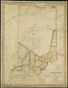
Map of Indiana
59.
A map of part of the N:W: Territory of the United States : compiled from actual surveys, and the best information
60.
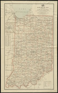
Post route map of the state of Indiana showing post offices with the intermediate distances on mail routes in operation on the...
‹ Prev
Next ›
1
2
3
4
5
6
7
…
438
439