Toggle navigation
LMEC Home
Exhibitions
Georeferencing
Tools for Teachers
Collections
My Favorites
Sign Up / Log In
Search
Search the map portal
Map Collection
Map Collection
Map Sets
Search
Search
Search for
Search In
All Fields
Creator
Title
Subject
Place
Search All Digital Collections
Advanced Search
9020 Results
My Search
Start Over
More Like
commonwealth:wd376542k
Remove constraint More Like: commonwealth:wd376542k
Filter your Search
Place
North and Central America
6,247
United States
5,130
Massachusetts
2,099
Europe
1,396
Suffolk (county)
1,067
Boston
1,035
Canada
463
Asia
438
more
Place
»
Topic
Boston (Mass.)--Maps
595
United States--History--Revolution, 1775-1783--Maps
330
United States--Maps
283
Real property--Massachusetts--Boston--Maps
175
Massachusetts--Maps
163
Landowners--Massachusetts--Boston--Maps
133
New England--Maps
103
North America--Maps--Early works to 1800
103
more
Topic
»
Date
Date range begin
–
Date range end
Current results range from
1482
to
2023
View distribution
Creator
United States. Hydrographic Office
595
O.H. Bailey & Co
148
Des Barres, Joseph F. W. (Joseph Frederick Wallet), 1722-1824
124
United States. Post Office Dept
120
Ptolemy, 2nd cent
100
Walling, Henry Francis, 1825-1888
94
Geological Survey (U.S.)
86
Jefferys, Thomas, -1771
86
more
Creator
»
Format
Maps/Atlases
8,955
Manuscripts
219
Prints
56
Books
36
Drawings/Illustrations
13
Objects/Artifacts
10
Posters
5
Georeferenced
Yes
871
No
8,149
Collection
Norman B. Leventhal Map & Education Center Collection
8,696
Boston and New England Maps
2,233
Urban Maps
2,023
Maritime Charts and Atlases
1,083
American Revolutionary War-Era Maps
941
William L. Clements Library Collection
305
Boston Redevelopment Authority Collection
87
Maps from AAS
8
more
Collection
»
Available to use
No known restrictions
8,555
Creative Commons license
52
Search Constraints
Sort by relevance
relevance
title
date (asc)
date (desc)
Number of results to display per page
20 per page
10
per page
20
per page
50
per page
100
per page
View results as:
grid view
map view
Search Results
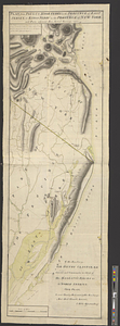
161.
Plan du combat du 12 Avril 1782 présenté par le chr. Dethy capne. du vass. de roy le Citoyen : Première position des deux...
162.
Plan du siége d'York par l'armée combinée commandée par les generaux Washington et Cte. de Rochambeau
163.
Plan figuratif du combat du 12 Avril 1782 entre l'armée angloise comandée par l'Amiral Rodney ... & l'armée Françoise commandée...
164.
Plan figuratif du combat du 9 Avril 1782 entre l'armée anglaise comandée par l'amiral Rodney ... & l'armée Française commandée...
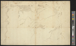
165.
Plan from Paulus Hook ferry in the province of East Jersey, to King's Ferry in the province of New York and parts adjacent from...
166.
Plan from St. Marys to St. Johns
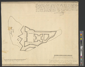
167.
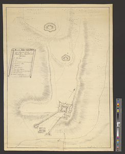
Plan of a fortification who seems necessary on Shutters Folly Island to second the firing of Fort Johnson on any vessel that...
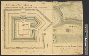
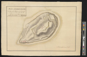
168.
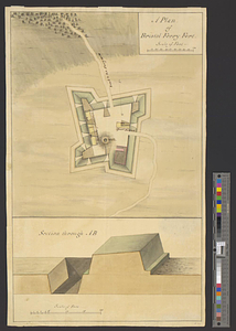
Plan of an intrench'd guard house at the north end of Howlands Neck, June 1777
169.
A plan of Boston in New England with its environs, including Milton, Dorchester, Roxbury, Brooklin, Cambridge, Medford,...
170.
A plan of Bristol Ferry fort
171.
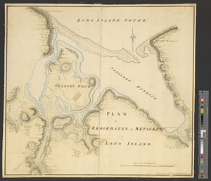
A plan of Brookhaven or Setalket Harbour with its environs
172.
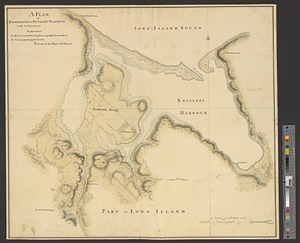
Plan of Brookhaven, or Setalket on Long Island
173.
A Plan of Charles Town the capitol of South Carolina, : with the harbour, islands, and forts; the attack on Fort Sulivan, by...
174.
Plan of Charleston and its defenses 1780
175.
Plan of Charlestown 1781
176.
Plan of Fort Brown, for 4 guns en barbette; with a small redout, and a line for 60 men, and a barrack
177.
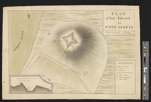
Plan of Fort Edward in Nova Scotia
178.
Plan of Fort George and adjacent works at Pensacola in West Florida
179.
Plan of Georges Island : NB where the platforms are expres'd the guns are mounted but the merlons are not repaired
180.
Plan of ground about Wilmington
‹ Prev
Next ›
1
2
…
5
6
7
8
9
10
11
12
13
…
450
451