Toggle navigation
LMEC Home
Exhibitions
Georeferencing
Tools for Teachers
Collections
My Favorites
Sign Up / Log In
Search
Search the map portal
Map Collection
Map Collection
Map Sets
Search
Search
Search for
Search In
All Fields
Creator
Title
Subject
Place
Search All Digital Collections
Advanced Search
8549 Results
My Search
Start Over
More Like
commonwealth:wd376390t
Remove constraint More Like: commonwealth:wd376390t
Filter your Search
Place
North and Central America
5,844
United States
4,768
Massachusetts
2,052
Europe
1,359
Suffolk (county)
1,034
Boston
1,007
Canada
448
Asia
422
more
Place
»
Topic
Boston (Mass.)--Maps
577
United States--Maps
273
Real property--Massachusetts--Boston--Maps
174
Massachusetts--Maps
160
Landowners--Massachusetts--Boston--Maps
132
North America--Maps--Early works to 1800
103
New England--Maps
99
Europe--Maps
78
more
Topic
»
Date
Date range begin
–
Date range end
Current results range from
1482
to
2023
View distribution
Creator
United States. Hydrographic Office
594
O.H. Bailey & Co
147
Des Barres, Joseph F. W. (Joseph Frederick Wallet), 1722-1824
123
United States. Post Office Dept
120
Ptolemy, 2nd cent
100
Walling, Henry Francis, 1825-1888
94
Geological Survey (U.S.)
86
Jefferys, Thomas, -1771
85
more
Creator
»
Format
Maps/Atlases
8,490
Manuscripts
215
Prints
56
Books
36
Objects/Artifacts
10
Drawings/Illustrations
8
Posters
4
Georeferenced
Yes
869
No
7,680
Collection
Norman B. Leventhal Map & Education Center Collection
8,549
Boston and New England Maps
2,203
Urban Maps
1,935
Maritime Charts and Atlases
1,081
American Revolutionary War-Era Maps
616
Boston Redevelopment Authority Collection
87
Available to use
No known restrictions
8,408
Creative Commons license
46
Search Constraints
Sort by relevance
relevance
title
date (asc)
date (desc)
Number of results to display per page
20 per page
10
per page
20
per page
50
per page
100
per page
View results as:
grid view
map view
Search Results
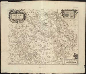
1941.
Dioecese de Rheims, et le païs de Rethel
1942.
Diqiu quan tu
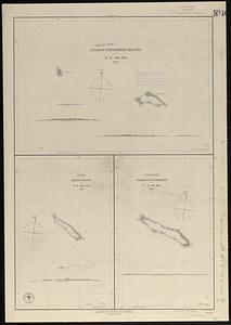
1943.
Disappointment Group ; Reao or Serle Island ; Pukaruha or Clermont-Tonnere
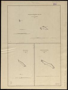
1944.
Disappointment Group ; Serle Island ; Clermont-Tonnere
1945.
Disconnected : Boston's free wi-fi leaves many in the dark
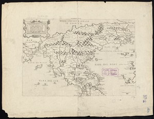
1946.
Il disegno del discoperto della noua Franza : ilquale s'è hauuto ultimamente dalla nouissima nauigatione dè Franzesi in quel...
1947.
Distribution of the colored population of the United States : 1890
1948.
Distribution of the iron ores mined in the Lake Superior Region in the year 1902
1949.
Distribution of the magnetic declination in the United States in 1900
1950.
Distribution of the population of the United States : 1890
1951.
District map of the lower Mississippi River
1952.
District within fire limit of Tokyo - 1928
1953.
Disturnell's new map of the United States and Canada showing all the canals, rail roads, telegraph lines and principal stage...
1954.
Diversi globi terr-aquei statione variante et visu intercedente, per coluros tropicorum, per ambos polos et particul : sphaerae...
1955.
Dobroudja Campaigne, Oct. 1916 : Volhynie Campaigne, Oct. 1916 ; Izonzo Campaigne, Oct. 1916
1956.
Dodge County, Wis.
1957.
Dodgeville, Massachusetts
1958.
Domina Anglorum in America Septentrionali specialibus mappis Londini primum a Mollio edita, nunc recusa ab Homannianis Hered =...
1959.
Dominia anglorum in præcipuis insulis Americæ ut sunt insula : S. Christophori, Antegoa, Iamaica, Barbados : nec non insulae...
1960.
Dominica
‹ Prev
Next ›
1
2
…
94
95
96
97
98
99
100
101
102
…
427
428