Toggle navigation
LMEC Home
Exhibitions
Georeferencing
Tools for Teachers
Collections
My Favorites
Sign Up / Log In
Search
Search the map portal
Map Collection
Map Collection
Map Sets
Search
Search
Search for
Search In
All Fields
Creator
Title
Subject
Place
Search All Digital Collections
Advanced Search
8638 Results
My Search
Start Over
More Like
commonwealth:wd376241p
Remove constraint More Like: commonwealth:wd376241p
Filter your Search
Place
North and Central America
5,882
United States
4,802
Massachusetts
2,065
Europe
1,388
Suffolk (county)
1,040
Boston
1,013
Canada
449
Asia
436
more
Place
»
Topic
Boston (Mass.)--Maps
581
United States--Maps
279
Real property--Massachusetts--Boston--Maps
175
Massachusetts--Maps
161
Landowners--Massachusetts--Boston--Maps
133
North America--Maps--Early works to 1800
103
New England--Maps
101
Europe--Maps
79
more
Topic
»
Date
Date range begin
–
Date range end
Current results range from
1482
to
2023
View distribution
Creator
United States. Hydrographic Office
595
O.H. Bailey & Co
148
Des Barres, Joseph F. W. (Joseph Frederick Wallet), 1722-1824
123
United States. Post Office Dept
120
Ptolemy, 2nd cent
100
Walling, Henry Francis, 1825-1888
94
Geological Survey (U.S.)
86
Jefferys, Thomas, -1771
85
more
Creator
»
Format
Maps/Atlases
8,579
Manuscripts
215
Prints
56
Books
36
Objects/Artifacts
10
Drawings/Illustrations
8
Posters
4
Georeferenced
Yes
869
No
7,769
Collection
Norman B. Leventhal Map & Education Center Collection
8,638
Boston and New England Maps
2,219
Urban Maps
1,984
Maritime Charts and Atlases
1,083
American Revolutionary War-Era Maps
616
Boston Redevelopment Authority Collection
87
Available to use
No known restrictions
8,496
Creative Commons license
47
Search Constraints
Sort by relevance
relevance
title
date (asc)
date (desc)
Number of results to display per page
20 per page
10
per page
20
per page
50
per page
100
per page
View results as:
grid view
map view
Search Results
7641.
State of Oregon
7642.
The State of Pennsylvania
7643.
The state of Pennsylvania : reduced with permission from Reading Howells map
7644.
The state of Rhode Island
7645.
The state of Rhode Island : compiled from the surveys and observations of Caleb Harris
7646.
The state of South Carolina : from the best authorities
7647.
State of South Dakota
7648.
State of Tennessee coal fields and producing districts
7649.
State of Virginia : stations and transmission lines used in public service in 1925 and gaging stations
7650.
State of Virginia coal fields and producing districts, September 1919
7651.
The state of Virginia from the best authorities
7652.
State of West Virginia and part of Maryland : coal fields and producing districts
7653.
State of West Virginia, stations and transmission lines used in public service in 1921
7654.
State of Wisconsin
7655.
The state of Wisconsin
7656.
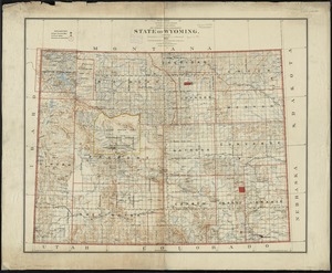
State of Wyoming
7657.
[Statement and plan of the Bill estate]
7658.
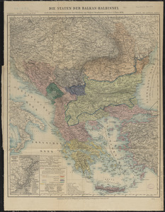
Die staten der Balkan-Halbinsel : nach den Grenzbestimmungen des Friedens von Haġios Stephanos (S. Stefano) 3. März 1878
7659.
States of America, drawn from the best authorities
7660.
The states of Maryland and Delaware, from the latest surveys
‹ Prev
Next ›
1
2
…
379
380
381
382
383
384
385
386
387
…
431
432


![[Statement and plan of the Bill estate]](https://bpldcassets.blob.core.windows.net/derivatives/images/commonwealth:1257bc08v/image_thumbnail_300.jpg)