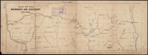
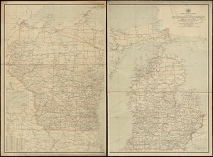
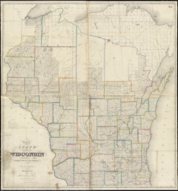
The state of Wisconsin
Item Information
- Title:
- The state of Wisconsin
- Creator:
- Lapham, Increase Allen, 1811-1875
- Name on Item:
-
compiled from the latest authorities by I.A. Lapham.
- Date:
-
1857
- Format:
-
Maps/Atlases
- Location:
-
Boston Public Library
Norman B. Leventhal Map & Education Center - Collection (local):
-
Norman B. Leventhal Map & Education Center Collection
- Subjects:
-
Railroads--Wisconsin--Maps
Wisconsin--Maps
- Places:
-
Wisconsin
- Extent:
- 1 map on 4 sheets : hand col. ; 131 x 124 cm., sheets 83 x 74 cm. and 82 x 72 cm.
- Terms of Use:
-
No known copyright restrictions.
No known restrictions on use.
- Publisher:
-
Milwaukee, Wis :
Dyer & Pasmore
- Scale:
-
Scale 1:380,160. 6 miles to one inch.
- Language:
-
English
- Notes:
-
Shows mines, meandered and not meandered streams, plank roads, and rail roads.
Relief shown by hachures and spot heights. Depth shown by soundings.
Includes "Profile of the Milwaukee and Mississippi Rail Road."
"Entered according to Act of Congress in the year 1849 by Increase A. Lapham in the Clerks office of the District Court of Wisconsin."
BPL copy assembled and mounted on cloth.
- Identifier:
-
06_01_011291
- Call #:
-
G4120 1857 .L37
- Barcode:
-
39999065683573