Toggle navigation
LMEC Home
Exhibitions
Georeferencing
Tools for Teachers
Collections
My Favorites
Sign Up / Log In
Search
Search the map portal
Map Collection
Map Collection
Map Sets
Search
Search
Search for
Search In
All Fields
Creator
Title
Subject
Place
Search All Digital Collections
Advanced Search
8832 Results
My Search
Start Over
More Like
commonwealth:w9505r879
Remove constraint More Like: commonwealth:w9505r879
Filter your Search
Place
North and Central America
6,009
United States
4,859
Massachusetts
2,079
Europe
1,396
Suffolk (county)
1,046
Boston
1,019
Canada
454
Asia
441
more
Place
»
Topic
Boston (Mass.)--Maps
586
United States--Maps
282
North America--Maps--Early works to 1800
240
Real property--Massachusetts--Boston--Maps
175
Massachusetts--Maps
162
Landowners--Massachusetts--Boston--Maps
133
New England--Maps
102
Europe--Maps
79
more
Topic
»
Date
Date range begin
–
Date range end
Current results range from
1482
to
2023
View distribution
Creator
United States. Hydrographic Office
595
O.H. Bailey & Co
148
Des Barres, Joseph F. W. (Joseph Frederick Wallet), 1722-1824
123
United States. Post Office Dept
120
Ptolemy, 2nd cent
100
Walling, Henry Francis, 1825-1888
94
Jefferys, Thomas, -1771
92
Sayer, Robert, 1725-1794
87
more
Creator
»
Format
Maps/Atlases
8,772
Manuscripts
217
Prints
56
Books
36
Objects/Artifacts
10
Drawings/Illustrations
8
Posters
5
Georeferenced
Yes
872
No
7,960
Collection
Norman B. Leventhal Map & Education Center Collection
8,704
Boston and New England Maps
2,234
Urban Maps
2,023
Maritime Charts and Atlases
1,083
American Revolutionary War-Era Maps
738
Boston Redevelopment Authority Collection
87
MacLean Collection Map Library
59
New York Public Library Collection
32
more
Collection
»
Available to use
No known restrictions
8,556
Creative Commons license
111
Search Constraints
Sort by relevance
relevance
title
date (asc)
date (desc)
Number of results to display per page
20 per page
10
per page
20
per page
50
per page
100
per page
View results as:
grid view
map view
Search Results
101.
Tierra nveva
102.
To the Right Honourable John Lord Sommers, Baron of Evesham in ye county of Worcester, president of Her Majesty's most...
103.
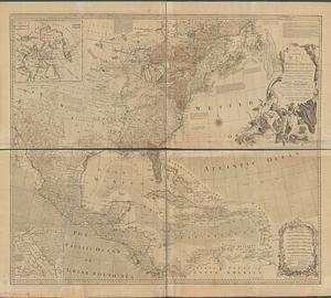
[A map of the east coast of America from Newfoundland to the Bay of Honduras]
104.
An accurate map of North America : Describing and distinguishing the British and Spanish dominions of this great continent;...
105.
An accurate map of North America : describing and distinguishing the British and Spanish dominions on this great continent :...
106.
An accurate map of North America : describing and distinguishing the British and Spanish dominions on this great continent :...
107.
An accurate map of North America describing and distinguishing the British, Spanish and French dominions on this great...
108.
An accurate map of the British Empire in Nth. America as settled by the preliminaries in 1762
109.
An accurate map of the British, French & Spanish settlements in Nth. America and the West Indies : as stipulated by the...
110.
An Accurate map of the present seat of war between Great-Britain and her colonies in North America
111.
Acurate charte von Nord-America : aus dem besten quellen
112.
America settentrionale divisa ne' suoi principali stati
113.
America sive novvs orbis respectv Evropaeorvm inferior globi terrestris pars
114.
Americae pars Borealis, Florida, Baccalaos, Canada, Corterealis
115.
L'Amerique divisée en septentrionale et méridionale, subdivisée en ses principales parties, dressée sur les relations les...
116.
L'Amérique septentrionale
117.
Amérique septentrionale avec les routes, distances en miles, limites et etablissements françois et anglois
118.
Amerique Septentrionale avec les routes, distances en miles, villages et etablissements françois et anglois = North America
119.
Amerique Septentrionale avec les routes, distances en miles, villages et etablissements françois et anglois = North America
120.
Amerique Septentrionale avec les routes, distances en miles, villages et etablissements françois et anglois = North America
‹ Prev
Next ›
1
2
3
4
5
6
7
8
9
10
…
441
442


![[A map of the east coast of America from Newfoundland to the Bay of Honduras]](https://bpldcassets.blob.core.windows.net/derivatives/images/commonwealth:hx11z584h/image_thumbnail_300.jpg)