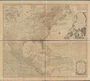
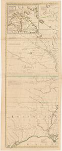
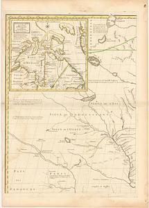
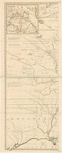
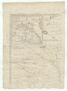
Amerique Septentrionale avec les routes, distances en miles, villages et etablissements françois et anglois = North America
This map is also available in American Revolutionary Geographies Online (ARGO), a collections portal especially built for material relating to the American Revolutionary War Era. Visit ARGO to learn more about this item and explore the historical geography of North America in the late eighteenth century.
Item Information
- Title:
- Amerique Septentrionale avec les routes, distances en miles, villages et etablissements françois et anglois = North America
- Cartographer:
- Mitchell, John, 1711-1768
- Publisher:
- Le Rouge, Georges-Louis
- Name on Item:
-
par le Docteur Mitchel traduit de l'anglois ; corigée en 1776 par M. Hawkins Brigadier des Armées du Roy
- Date:
-
1777
- Format:
-
Maps/Atlases
- Location:
- MacLean Collection Map Library
- Collection (local):
-
MacLean Collection Map Library
- Subjects:
-
North America--Maps--Early works to 1800
- Places:
-
North America (area)
- Extent:
- 1 map ; 1626 x 2325 mm
- Terms of Use:
-
Public Domain/No known restrictions on use. Contact host institution to download image.
Contact host institution for more information.
- Publisher:
-
Paris :
par Le Rouge Ing.r Geographe du Roy rue des Grands Augustins
- Language:
-
French
German
- Identifier:
-
MC_1849
- Call #:
-
1849