Toggle navigation
LMEC Home
Exhibitions
Georeferencing
Tools for Teachers
Collections
My Favorites
Sign Up / Log In
Search
Search the map portal
Map Collection
Map Collection
Map Sets
Search
Search
Search for
Search In
All Fields
Creator
Title
Subject
Place
Search All Digital Collections
Advanced Search
8840 Results
My Search
Start Over
More Like
commonwealth:tt44pv45d
Remove constraint More Like: commonwealth:tt44pv45d
Filter your Search
Place
North and Central America
6,071
United States
4,989
Massachusetts
2,091
Europe
1,396
Suffolk (county)
1,191
Boston
1,164
Canada
449
Asia
438
more
Place
»
Topic
Boston (Mass.)--Maps
608
United States--Maps
282
Real property--Massachusetts--Boston--Maps
253
Landowners--Massachusetts--Boston--Maps
169
City planning--Massachusetts--Boston--Maps
167
Massachusetts--Maps
162
North America--Maps--Early works to 1800
103
New England--Maps
102
more
Topic
»
Date
Date range begin
–
Date range end
Current results range from
1482
to
2023
View distribution
Creator
United States. Hydrographic Office
595
Boston Redevelopment Authority
169
O.H. Bailey & Co
148
Des Barres, Joseph F. W. (Joseph Frederick Wallet), 1722-1824
123
United States. Post Office Dept
120
Ptolemy, 2nd cent
100
Walling, Henry Francis, 1825-1888
94
Geological Survey (U.S.)
86
more
Creator
»
Format
Maps/Atlases
8,780
Manuscripts
215
Prints
56
Books
36
Objects/Artifacts
10
Drawings/Illustrations
8
Posters
5
Georeferenced
Yes
872
No
7,968
Collection
Norman B. Leventhal Map & Education Center Collection
8,698
Boston and New England Maps
2,343
Urban Maps
2,132
Maritime Charts and Atlases
1,083
American Revolutionary War-Era Maps
616
Boston Redevelopment Authority Collection
194
Massachusetts Real Estate Atlases
35
Applied Geographics, Inc. Records
2
more
Collection
»
Available to use
No known restrictions
8,661
Creative Commons license
49
Search Constraints
Sort by relevance
relevance
title
date (asc)
date (desc)
Number of results to display per page
20 per page
10
per page
20
per page
50
per page
100
per page
View results as:
grid view
map view
Search Results
181.
Map of the town of Roxbury : surveyed by order of the town authorities
182.
Map of the town of Roxbury
183.
A new & complete map of the city of Boston, with part of Charlestown, Cambridge & Roxbury
184.
A new & complete map of the city of Boston, with part of Charlestown, Cambridge & Roxbury
185.
A new & complete map of the city of Boston, with part of Charlestown, Cambridge & Roxbury
186.
Parcel 22
187.
Plan of Boston and Roxbury
188.
Plan of the Roxbury Canal lands belonging to the city of Boston to be sold by public auction on Saturday May 19th 1883 at 3...
189.
A plan of the salt marsh and upland in Roxbury, lying the east side of the Mill Creek
190.
Topographical map of Cedar Square, Roxbury
191.
Views of the area around Dudley Station in Roxbury
192.
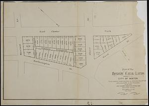
Woodland Cemetery in Dorchester and Roxbury main entrance on Walk-Hill Street : five miles from Boylston market, direct route...
193.
Boston urban wilds : ownership
194.
Historical map of the north and central parts of Old Boston : with explanatory key
195.
Plan accompanying the proposal made to the City of Boston by the Commissioners on Boston Harbor and the Back Bay Octr. 20, 1854...
196.
Plan of Boston showing existing ways and owners on December 25, 1630
197.
Plan of Boston showing existing ways and owners on December 25, 1630
198.
Plan of Boston showing existing ways and owners on December 25, 1631
199.
Plan of Boston showing existing ways and owners on December 25, 1632
200.
Plan of Boston showing existing ways and owners on December 25, 1633
‹ Prev
Next ›
1
2
…
6
7
8
9
10
11
12
13
14
…
441
442